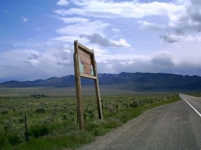
Near Malta in Cassia County, Idaho — The American West (Mountains)
Hudspeth's Cutoff
Opened by "Messrs. Hudspeth & Myers, of the Jackson County, Missouri, Company," who reached here on July 24, 1849, this new route was mistakenly thought to save nearly a hundred miles over the old way along Snake River to the north. From here, the 49'ers struck southwest for California and golden riches.
Erected by Idaho Historical Society. (Marker Number 169.)
Topics and series. This historical marker is listed in this topic list: Settlements & Settlers. In addition, it is included in the California Trail, and the Idaho State Historical Society series lists. A significant historical month for this entry is July 1904.
Location. 42° 17.404′ N, 113° 24.96′ W. Marker is near Malta, Idaho, in Cassia County. Marker is on State Highway 77 at milepost 3,, 0.6 miles east of 1700 S. Road, on the right when traveling east. Touch for map. Marker is in this post office area: Malta ID 83342, United States of America. Touch for directions.
Other nearby markers. At least 8 other markers are within 12 miles of this marker, measured as the crow flies. Where Trails Meet - Raft River Valley Trails (approx. 0.6 miles away); California Trail - Cassia Creek (approx. one mile away); Mc Clendon Springs (approx. 3.2 miles away); California Trail - Leaving Cassia Creek (approx. 7.8 miles away); Idahome (approx. 8.6 miles away); California Trail - Raft River Valley (approx. 9.6 miles away); California Trail - Summit Creek (approx. 11.7 miles away); California Trail (approx. 11.7 miles away). Touch for a list and map of all markers in Malta.
Credits. This page was last revised on June 16, 2016. It was originally submitted on June 7, 2010, by Rebecca Maxwell of Boise, Idaho. This page has been viewed 1,767 times since then and 61 times this year. Photos: 1, 2. submitted on June 7, 2010, by Rebecca Maxwell of Boise, Idaho. • Craig Swain was the editor who published this page.

