Near Winchester in Frederick County, Virginia — The American South (Mid-Atlantic)
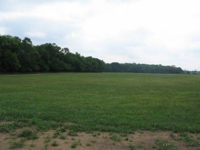
The Third Battle of Winchester
The Second Woods
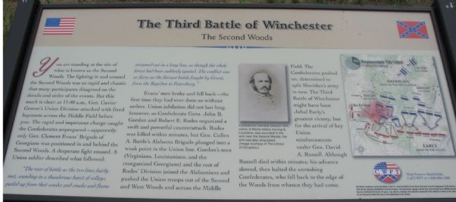
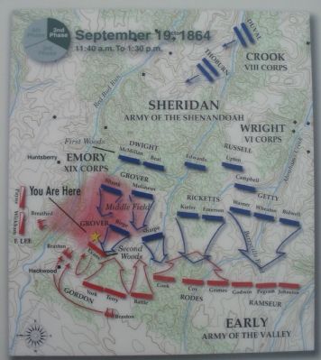
Evans' men broke and fell back - the first time they had ever done so without orders. Union jubilation did not last long, however, as Confederate Gens. John B. Gordon and Robert E. Rodes organized a swift and powerful counterattack. Rodes was killed within minutes, but Gen. Cullen A. Battle's Alabama Brigade plunged into a weak point in the Union line. Gordon's men (Virginians, Louisianians, and the reorganized Georgians) and the rest of Rodes' Division joined the Alabamians and pushed the Union troops out of the Second and West Woods and across the Middle Field. The Confederates pushed on, determined to split Sheridan's army in two. The Third Battle of Winchester might have been Jubal Early's greatest victory, but for the arrival of key Union reinforcements under Gen. David A. Russell. Although Russell died within minutes, his advance slowed, then halted the onrushing Confederates, who fell back to the edge of the Woods from whence they had come.
Erected by Civil War Preservation Trust.
Topics. This historical marker is listed in this topic list: War, US Civil.
Location. Marker has been reported permanently removed. It was located near 39° 12.015′ N, 78° 7.841′ W. Marker was near Winchester, Virginia, in Frederick County. Marker could be reached from Redbud Road (County Route 661), on the right when traveling east. Located at the Second Woods Wayside, along the Battle Trail, inside the CWPT Third Winchester Battlefield site. The closest trailhead to this marker is along Redbud Road. Touch for map. Marker was in this post office area: Winchester VA 22603, United States of America.
We have been informed that this sign or monument is no longer there and will not be replaced. This page is an archival view of what was.

2. Help Preserve 3rd Winchester
Details of CWPT efforts to save this battlefield.
Click for more information.
Click for more information.
Other nearby markers. At least 8 other markers are within walking distance of this location. Bloody Repulse (within shouting distance of this marker); Breaking the Deadlock (about 700 feet away, measured in a direct line); Major General Robert Emmett Rodes (approx. 0.2 miles away); Counterattack! (approx. 0.2 miles away); Hackwood And Patton (approx. 0.2 miles away); Alabama (approx. 0.2 miles away); The Cost of Battle (approx. ¼ mile away); Fury On The Fence Line (approx. ¼ mile away). Touch for a list and map of all markers in Winchester.
More about this marker. In the center is a portrait of "Confederate General Zebulon York, native of Maine before moving to Louisiana, was wounded in the arm near the Second Woods. His arm was later amputated." On the right, a map illustrates the tactical situation between 11:40 a.m. and 1:30 p.m. on September 19, 1864.
Also see . . .
1. Summary of the Battle of Third Winchester. The action described on the marker falls under Phase 4 of this National Parks Service summary. (Submitted on October 27, 2007, by Craig Swain of Leesburg, Virginia.)
2. CWPT Walking Tour of The Third Battle of Winchester. This marker is one along the walking trail around a portion of the Third Winchester Battlefield, preserved by the Civil War Preservation Trust. (Submitted on October 27, 2007, by Craig Swain of Leesburg, Virginia.)

Photographed By Craig Swain, August 26, 2007
5. Federal Advance
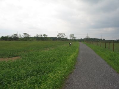
Hackwood lane is on the left side of the photo, although the trees along the lane were not present at the time of the battle. Birge's Federal Brigade drove through the field here, towards the camera, and pressed Evans' Confederate Brigade. The Middle Field wayside marker can barely be seen in the distance.
Credits. This page was last revised on April 28, 2023. It was originally submitted on October 27, 2007. This page has been viewed 1,530 times since then and 11 times this year. Last updated on November 12, 2020, by Bradley Owen of Morgantown, West Virginia. Photos: 1. submitted on October 27, 2007, by Craig Swain of Leesburg, Virginia. 2. submitted on March 13, 2009, by Craig Swain of Leesburg, Virginia. 3, 4, 5. submitted on October 27, 2007, by Craig Swain of Leesburg, Virginia. • J. Makali Bruton was the editor who published this page.


