Waterford in Erie County, Pennsylvania — The American Northeast (Mid-Atlantic)
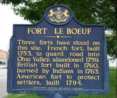
Fort Le Boeuf
Erected by Pennsylvania Historical Museum Commission.
Topics and series. This historical marker is listed in these topic lists: Colonial Era • Forts and Castles • Military • Native Americans • Settlements & Settlers • War, French and Indian • Wars, US Indian. In addition, it is included in the Pennsylvania Historical and Museum Commission series list. A significant historical year for this entry is 1753.
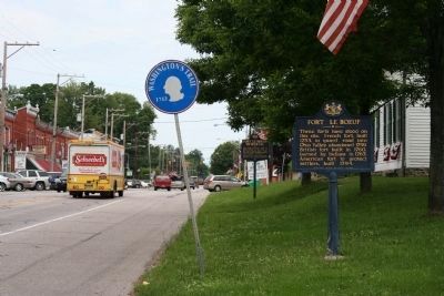
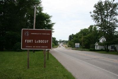
Location. 41° 56.405′ N, 79° 58.952′ W. Marker is in Waterford, Pennsylvania, in Erie County. Marker is on High Street (U.S. 19) north of East 1st Alley, on the left when traveling south. This historical marker is located on the south side of the downtown business district, on the east side of the road. It is on the opposite side of the street from the George Washington Memorial Park, and just north of the state owned and maintained Fort Le Boeuf history museum. Touch for map. Marker is in this post office area: Waterford PA 16441, United States of America. Touch for directions.
Other nearby markers. At least 8 other markers are within walking distance of this marker. George Washington (within shouting distance of this marker); Fort Le Boeuf Memorial (within shouting distance of this marker); a different marker also named Fort Le Boeuf (within shouting distance of this marker); Site of Fort Le Boeuf (within shouting distance of this marker); Fort Sur La Rivière Aux Boeufs (within shouting distance of this marker); Near This Site (within shouting distance of this marker); Eagle Hotel (within shouting distance of this marker); Col. Strong Vincent (within shouting distance of this marker). Touch for a list and map of all markers in Waterford.
More about this marker. This historical marker is located at the northern end of the "Washington's Trail-1753," which marks the pathway, through Pennsylvania, that George Washington took when sent on his diplomatic mission by Virginia's colonial governor, Governor Dinwiddie, to the French at Fort Le Boeuf, in present day Waterford, Pennsylvania.
Also see . . . Fort LeBoeuf - Behind the Marker. ExplorePAhistory is your gateway to Pennsylvania, past and present. (Submitted on June 19, 2010, by Dale K. Benington of Toledo, Ohio.)

Photographed By Dale K. Benington, June 14, 2010
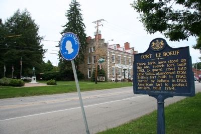
2. Fort Le Boeuf Marker
View of historical marker, looking north towards the downtown business district of Waterford, with a view of the Fort Le Boeuf Memorial historical marker in the background. Note the "Washington Trail - 1753" roadway marker, in it's location immediately adjacent to the historical marker.
Credits. This page was last revised on June 16, 2016. It was originally submitted on June 17, 2010, by Dale K. Benington of Toledo, Ohio. This page has been viewed 1,097 times since then and 27 times this year. Photos: 1, 2, 3, 4. submitted on June 17, 2010, by Dale K. Benington of Toledo, Ohio.


