Near Oriskany in Oneida County, New York — The American Northeast (Mid-Atlantic)
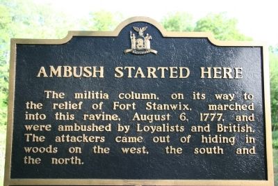
Ambush Started Here
Topics. This historical marker is listed in these topic lists: Military • Native Americans • War, US Revolutionary. A significant historical year for this entry is 1777.
Location. 43° 10.529′ N, 75° 22.098′ W. Marker is near Oriskany, New York, in Oneida County. Marker is on Rome Oriskany Road (New York State Route 69) 0.4 miles east of Monument Road, on the left when traveling east. Touch for map. Marker is in this post office area: Oriskany NY 13424, United States of America. Touch for directions.
Other nearby markers. At least 8 other markers are within walking distance of this marker. The Military Road (within shouting distance of this marker); The Ambush: August 6, 1777 (within shouting distance of this marker); Aftermath of a Tragedy (within shouting distance of this marker); Near This Spot (about 300 feet away, measured in a direct line); General Herkimer's Troops (about 300 feet away); To The Unknown Patriotic Soldiers of Tryon County (about 300 feet away); Preserving a Memorial Park (about 300 feet away); Here the Battle of Oriskany Was Fought (about 700 feet away). Touch for a list and map of all markers in Oriskany.
More about this marker. This historical marker is part of a walking tour of the Oriskany Battlefield.

Photographed By Dale K. Benington, June 15, 2010
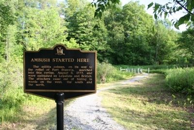
3. Ambush Started Here Marker
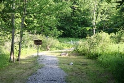
View from the crest on the west side of the ravine, looking down the military trail towards Oriskany Creek. The American forces would be from the historical marker back towards the bridge. The British forces would have been situated near from where this picture was taken.
Credits. This page was last revised on June 16, 2016. It was originally submitted on June 20, 2010, by Dale K. Benington of Toledo, Ohio. This page has been viewed 788 times since then and 16 times this year. Photos: 1, 2, 3. submitted on June 20, 2010, by Dale K. Benington of Toledo, Ohio.

