Niantic in East Lyme in New London County, Connecticut — The American Northeast (New England)
East Lyme
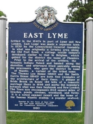
Settled in the 1640's in part of Lyme and New London. East Lyme was made a separate town in 1839 by the Connecticut General Assembly. In what was originally a farming area along the Old Post Road, a cottage textile indistry developed similar to that in Belgium, which gained for the district the name of Flanders. Prior to the arrival of the settlers, the Nehantic Indians fished and hunted along the shoreline, and afterward lived amicably among the newcomers, who gave the district its name of Niantic, a variant of the tribal name. The Thomas Lee House (1660) and the Smith Harris House (1840) are both fine examples of the architecture of their times. A plaque at Bride Brook on Route 156 tells of a romantic marriage there in 1646 and marks the boundary between what was then Saybrook and New London. The Town now encompasses 34.8 square miles of beaches, ponds, streams, woodland, and fields. It is a noted summer resort and the home of the famous Niantic sacllop, a popular seafood.
Erected 1980 by the Town of East Lyme, East Lyme Historical Society, Connecticut Historical Commission.
Topics. This historical marker is listed in these topic lists: Colonial Era • Settlements & Settlers. A significant historical year for this entry is 1839.
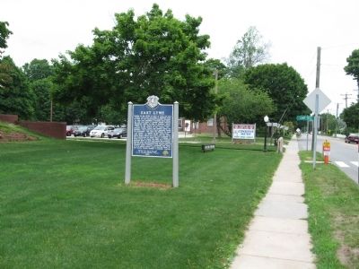
Location. 41° 19.659′ N, 72° 11.649′ W. Marker is in East Lyme, Connecticut, in New London County. It is in Niantic. Marker is at the intersection of Pennsylvania Avenue (Connecticut Route 161) and Smith Street, on the left when traveling north on Pennsylvania Avenue. Located in front of East Lyme Town Hall. Touch for map. Marker is at or near this postal address: 108 Pennsylvania Avenue, Niantic CT 06357, United States of America. Touch for directions.
Other nearby markers. At least 8 other markers are within 3 miles of this marker, measured as the crow flies. East Lyme Honor Roll (approx. 0.3 miles away); East Lyme Veterans Memorial (approx. 0.3 miles away); A Glimpse into the Past (approx. 0.3 miles away); The Iron Horse (approx. 0.3 miles away); A Place for Play (approx. 0.4 miles away); McCook Point (approx. 0.4 miles away); The Hole in the Wall (approx. 0.4 miles away); Bride Brook (approx. 2.6 miles away). Touch for a list and map of all markers in East Lyme.
Also see . . .
1. Town of East Lyme. (Submitted on June 27, 2010, by Michael Herrick of Southbury, Connecticut.)
2. East Lyme, Connecticut on Wikipedia. (Submitted on June 27, 2010, by Michael Herrick of Southbury, Connecticut.)
Credits. This page was last revised on June 25, 2023. It was originally submitted on June 27, 2010, by Michael Herrick of Southbury, Connecticut. This page has been viewed 984 times since then and 61 times this year. Photos: 1, 2. submitted on June 27, 2010, by Michael Herrick of Southbury, Connecticut.

