Waterloo in Howard County, Maryland — The American Northeast (Mid-Atlantic)
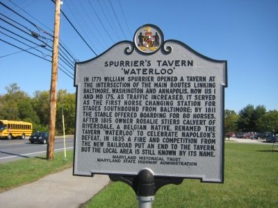
Spurrier's Tavern
'Waterloo'
Erected by Maryland Historical Trust, Maryland State Highway Administration.
Topics. This historical marker is listed in these topic lists: Colonial Era • Industry & Commerce • Railroads & Streetcars • Roads & Vehicles. A significant historical year for this entry is 1771.
Location. 39° 10.386′ N, 76° 46.922′ W. Marker is in Waterloo, Maryland, in Howard County. Marker is on Washington Boulevard (U.S. 1) 0.2 miles north of Waterloo Road (Maryland Route 175), on the right when traveling north. Touch for map. Marker is in this post office area: Jessup MD 20794, United States of America. Touch for directions.
Other nearby markers. At least 8 other markers are within 4 miles of this marker, measured as the crow flies. A different marker also named Spurrier's Tavern (approx. 0.2 miles away); Trinity on the Pike (approx. 0.8 miles away); Trinity White Oak (approx. 0.8 miles away); Christ Episcopal Church (approx. 2˝ miles away); Adam the First (approx. 3.1 miles away); Welcome to Rockburn Branch Park (approx. 3.2 miles away); The Patuxent Branch of the B&O Railroad (approx. 3.2 miles away); The Granite Quarries (approx. 3.2 miles away). Touch for a list and map of all markers in Waterloo.
Credits. This page was last revised on June 16, 2016. It was originally submitted on October 30, 2007, by F. Robby of Baltimore, Maryland. This page has been viewed 1,615 times since then and 26 times this year. Photo 1. submitted on October 30, 2007, by F. Robby of Baltimore, Maryland. • Kevin W. was the editor who published this page.
