Near Mendham in Morris County, New Jersey — The American Northeast (Mid-Atlantic)
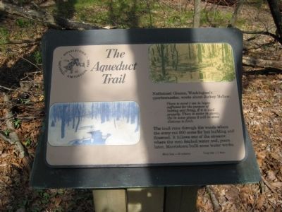
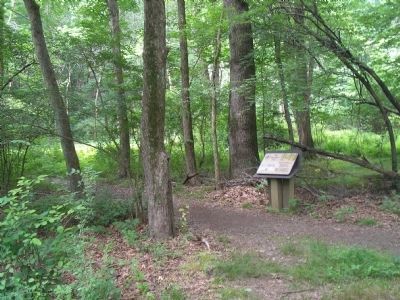
The Aqueduct Trail
There is wood I am in hopes is sufficient for the purpose of hunting and firing, if it is used properly. There is water in plenty, tho in some places it will be some distance to fetch.
The trail runs through the woods where the army cut 600 acres for hut building and firewood. It follows one of the streams where the men fetched water and, years later, Morristown built some waterworks.
Erected by Morristown National Historic Park.
Topics. This historical marker is listed in this topic list: War, US Revolutionary.
Location. 40° 45.767′ N, 74° 32.506′ W. Marker is near Mendham, New Jersey, in Morris County. Marker is on Jockey Hollow Road, on the right when traveling south. Touch for map. Marker is in this post office area: Mendham NJ 07945, United States of America. Touch for directions.
Other nearby markers. At least 8 other markers are within walking distance of this marker. Roads (a few steps from this marker); Hand’s Brigade (within shouting distance of this marker); The Wick Farm (about 400 feet away, measured in a direct line); a different marker also named The Wick Farm (about 400 feet away); Captain Adam Bettin (about 400 feet away); Wick Farm Garden (about 600 feet away); The Connecticut Line (approx. 0.2 miles away); The Second Maryland Brigade (approx. 0.4 miles away).
Also see . . . Morristown National Historic Park - National Park Service. (Submitted on April 29, 2009, by Bill Pfingsten of Bel Air, Maryland.)
Credits. This page was last revised on June 16, 2016. It was originally submitted on April 26, 2009, by Alan Edelson of Union Twsp., New Jersey. This page has been viewed 967 times since then and 13 times this year. Last updated on July 3, 2010, by Richard E. Miller of Oxon Hill, Maryland. Photos: 1. submitted on April 26, 2009, by Alan Edelson of Union Twsp., New Jersey. 2, 3, 4. submitted on April 29, 2009, by Bill Coughlin of Woodland Park, New Jersey. 5. submitted on April 26, 2009, by Alan Edelson of Union Twsp., New Jersey. • Craig Swain was the editor who published this page.


