Vallecito in Calaveras County, California — The American West (Pacific Coastal)
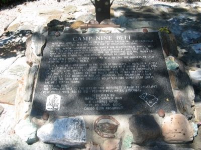
Camp Nine Bell
In 1906, Beach Thompson needing water for his hydraulic mining, and investors in San Francisco needing electric power came together to form the Union Construction Co. and the Stanislaus Electric Power Co. to build the Stanislaus Powerhouse – known as Camp Nine.
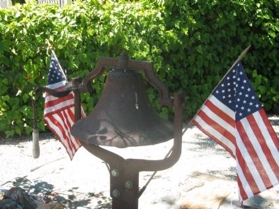
In the early days, the cook used the bell to call the workers to their morning and evening meals.
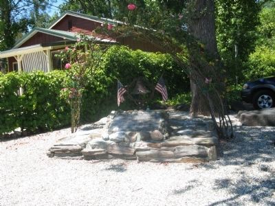
In 1923, the bell was given to the town of Vallecito. It hung in a locust tree on Main Street for 52 years. It was used as a firebell and to ring in the new year which became a tradition and one which continues to this day. In 1981, fearing for the bell’s safety, it was rescued by Dan Cooper, Dan Malatesta and Jim Saunders. The Malatesta family donated the land for the Vallecito Volunteer Fire Department where the bell stands today.
Historical Note:
The small cottage to the left of this monument served as Vallecito’s Post Office from 1891 to 1921. Postmistress Hattie Brockway
Erected 2005 by Matuca Chapter 1849, E Clampus Vitus – Clamper Year 6010.
Topics and series. This historical marker is listed in this topic list: Industry & Commerce . In addition, it is included in the E Clampus Vitus, and the Historic Bells series lists. A significant historical year for this entry is 1900.
Location. 38° 5.305′ N, 120° 28.37′ W. Marker is in Vallecito, California, in Calaveras County. Marker is on Main Street, 0.3 miles south of California Highway 4, on the right when traveling south. Marker is located at the southern entrance to the parking area of the Vallecito’s Volunteer Fire Department Fire Station. Touch for map. Marker is at or near this postal address: 3434 Main Street, Vallecito CA 95251, United States of America. Touch for directions.
Other nearby markers. At least 8 other markers are within 4 miles of this marker, measured as the crow flies. Vallecito (approx. 0.2 miles away); Dinkelspiel Store (approx. 0.2 miles away); The Italian Store (approx. 2.2 miles away); Joseph Schachten (approx. 3.2 miles away); Site of Brownsville (approx. 3.3 miles away); Ebbetts Pass Veterans Memorial (approx. 3.3 miles away); The Murphys Pokey (approx. 3.4 miles away); Murphys Grammar School (approx. 3.4 miles away). Touch for a list and map of all markers in Vallecito.
Credits. This page was last revised on June 16, 2016. It was originally submitted on July 6, 2010, by Syd Whittle of Mesa, Arizona. This page has been viewed 1,192 times since then and 10 times this year. Photos: 1, 2, 3, 4. submitted on July 6, 2010, by Syd Whittle of Mesa, Arizona.


