Near Frederick in Frederick County, Maryland — The American Northeast (Mid-Atlantic)
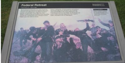
Federal Retreat
4:30-5:00 p.m. July 9, 1864
— Monocacy National Battlefield —
The Northerners held, then lost, then retook the Thomas house grounds as the fighting ebbed and flowed in the stifling heat. Casualties mounted quickly on both sides. Union Maj. Gen. Lew Wallace could see that his numbers were dwindling and that the Confederates were coming in waves. Wallace gave the order to retreat.
"Under a raking of fire of both musketry and artillery," his troops pulled back and fled to the northeast past Gambrill Mill to the road to Baltimore. The Confederates had won the battle, but the Union had won a critical one-day delay in Lt. Gen. Jubal A. Early's attempted raid on Washington.
(Sidebar): Total Casualties
Estimates vary greatly for troops and casualties in the Battle of Monocacy. The Union had approximately 5,800 men and suffered 1,294 killed, wounded, or missing. The Confederates had 15,000 to 16,000 troops and 700 to 900 casualities.
Erected by National Park Service, U.S. Department of the Interior.
Topics. This historical marker is listed in this topic list: War, US Civil.
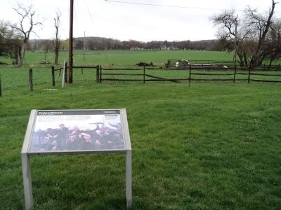
Location. Marker has been permanently removed. It was located near 39° 21.441′ N, 77° 23.461′ W. Marker was near Frederick , Maryland, in Frederick County. Marker was on Baker Valley Road, on the right when traveling south. Located at stop four of the auto-tour of Monocacy Battlefield. This marker set is at the trail head for the Thomas Farm walking tour. Touch for map. Marker was in this post office area: Frederick MD 21704, United States of America.
We have been informed that this sign or monument is no longer there and will not be replaced. This page is an archival view of what was.
Other nearby markers. At least 8 other markers are within walking distance of this location. Final Attack (within shouting distance of this marker); Civilians Under Siege (within shouting distance of this marker); 10th Vermont Monument (approx. 0.3 miles away); State of Pennsylvania Monument (approx. 0.3 miles away); Final Stand (approx. 0.3 miles away); Clustered Spires of Frederick (approx. half a mile away); History of the Monocacy River Valley (approx. half a mile away); The Battle That Saved Washington (approx. half a mile away). Touch for a list and map of all markers in Frederick.
More about this marker. The background is a painting of a Federal battle line in action.
Also see . . .
1. Battle of Monocacy. National Park Service site. (Submitted on November 3, 2007, by Craig Swain of Leesburg, Virginia.)
2. 10th Vermont Infantry. Regimental History. (Submitted on November 4, 2007, by Craig Swain of Leesburg, Virginia.)
3. National Park Service page on the 10th Vermont Monument. Note that the 10th Vermont had two of its members awarded the Medal of Honor for actions here at Monocacy. Lieutenant George Davis' heroics are discussed on the nearby "Fleeing for Their Lives" marker. Corporal Alexander Scott, who was actually a Canadian citizen, saved the regimental colors from capture. Also linked on the site is a letter from Private George M. Douse, of the regiment, describing his view of the battle. (Submitted on November 4, 2007, by Craig Swain of Leesburg, Virginia.)
Photographed By Craig Swain, September 9, 2007
3. Thomas Farm Tour Stop
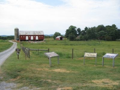
The Thomas Farm is stop four on the tour of the Monocacy Battlefield. The barn is part of the C. Keefer Thomas Farm, known as "Araby." The National Park Service is conducting preservation projects to stabilize the Thomas house and farm buildings.
Photographed By Craig Swain, May 26, 2007
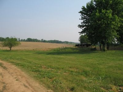
4. Final Attacks at Thomas Farm
At around 3:30 p.m., Confederate General Clement Evans led his brigade forward, through the Thomas Farm and attacked the left flank of Union General James Ricketts' Division. The Federal defensive line stretched across the open fields in the center frame. The Confederate line of attack was from the point of view of this photograph.
Photographed By Craig Swain, May 26, 2007
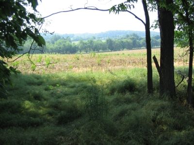
5. Terry's Attack on the Federal Right
On the opposite side of the field from Evans' Brigade, at around 4 p.m., Confederate General William Terry led his brigade forward to drive back the Federal right flank. As the attack gained momentum, Union troops fell back to the Georgetown Pike (the historical name for what is now Araby Church Road along this section of the battlefield). That final position is beyond the trees and valley in the foreground.
Photographed By Craig Swain, September 9, 2007
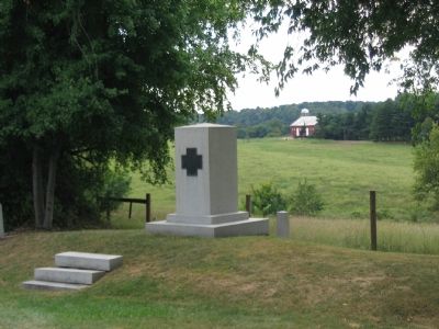
6. 10th Vermont Infantry Monument
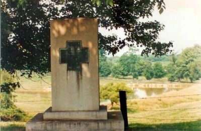
Standing at the intersection of Araby Church and Baker Valley Roads, this monument was dedicated in 1915. The 10th Vermont had defended a position between the Thomas Farm and the Baker Valley Road before Evans' Confederate Brigade finally pushed them back. The monument is located where the 10th Vermont stood along with other units on the final Federal defensive line in this sector of the battlefield, along the historical trace of the Georgetown Pike.
Note the location of the Thomas Farm barn, seen in the background.
Note the location of the Thomas Farm barn, seen in the background.
Photographed By Craig Swain, September 9, 2007
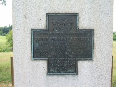
7. Inscription on the 10th Vermont Monument
was erected by the
State Of
Vermont
To designate the position of
the
Tenth Vermont Infantry
During the battle fought here
on the ninth day of July 1864
to save Washington, "and we saved it."
Seven companies occupied the Washington
Pike while three companies occupied
the Buckeystown
Road opposite the
Thomas House
1915
Credits. This page was last revised on April 27, 2022. It was originally submitted on November 3, 2007, by Craig Swain of Leesburg, Virginia. This page has been viewed 1,954 times since then and 38 times this year. Last updated on March 28, 2022, by Connor Olson of Kewaskum, Wisconsin. Photos: 1. submitted on November 3, 2007, by Craig Swain of Leesburg, Virginia. 2. submitted on April 23, 2011, by Bill Coughlin of Woodland Park, New Jersey. 3, 4, 5. submitted on November 3, 2007, by Craig Swain of Leesburg, Virginia. 6, 7. submitted on November 4, 2007, by Craig Swain of Leesburg, Virginia. 8. submitted on November 23, 2008, by Mike Stroud of Bluffton, South Carolina. • Bernard Fisher was the editor who published this page.
