Henrico in Henrico County, Virginia — The American South (Mid-Atlantic)
Fort Johnson
(sidebar)
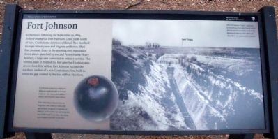
Confederate engineers employed defensive methods that were both centuries-old (sharpened stakes-abatis) and futuristic (land mines).
Their land mines, known then as torpedos, were artillery shells with special fuses designed to explode on contact. At Fort Johnson, and along the rest of the Confederate line, the mines were buried every two to five feet.
Erected 2010 by Richmond National Battlefield Park.
Topics. This historical marker is listed in these topic lists: Forts and Castles • War, US Civil. A significant historical month for this entry is September 1864.
Location. 37° 26.15′ N, 77° 22.642′ W. Marker is in Henrico, Virginia, in Henrico County . Marker is on Battlefield Park Road, 0.4 miles north of Picnic Road, on the left when traveling north. Touch for map. Marker is in this post office area: Henrico VA 23231, United States of America. Touch for directions.
Other nearby markers. At least 8 other markers are within walking distance of this marker. Fort Harrison (approx. 0.6 miles away); Richmond Defences (approx. 0.6 miles away); Freedom Fighters (approx. 0.6 miles away); First Park Headquarters (approx. 0.6 miles away); a different marker also named First Park Headquarters (approx. 0.6 miles away); Fort Harrison Trail (approx. 0.6 miles away); Confederate Counterattack (approx. 0.6 miles away); A Unique Photograph (approx. 0.6 miles away). Touch for a list and map of all markers in Henrico.
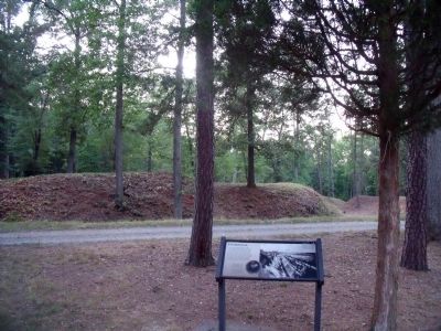
More about this marker. On the lower left is a picture of a land mine or "torpedo". On the right is a photo with the caption, "After the famous "Crater" explosion at Petersburg, both sides feared similar mining operations would occur in the Richmond defenses. Fort Johnson's deep ditch was a preventative measure."
Related marker. Click here for another marker that is related to this marker. Old Marker At This Location also titled "Fort Johnson".
Also see . . . Richmond National Battlefield Park. (Submitted on July 12, 2010.)
Credits. This page was last revised on November 5, 2021. It was originally submitted on July 12, 2010, by Bernard Fisher of Richmond, Virginia. This page has been viewed 1,054 times since then and 46 times this year. Photos: 1, 2, 3. submitted on July 12, 2010, by Bernard Fisher of Richmond, Virginia.


