Wells in Hamilton County, New York — The American Northeast (Mid-Atlantic)
Sacandaga Public Campsite
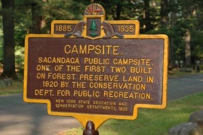
Campsite.
Sacandaga Public Campsite.
One of the First Two Built
On Forest Preserve Land In
1920 by the Conservation
Dept. For Public Recreation.
Erected 1935 by New York State Education and Conservation Departments.
Topics and series. This historical marker is listed in these topic lists: Environment • Government & Politics • Natural Features • Notable Places. In addition, it is included in the Civilian Conservation Corps (CCC) series list. A significant historical year for this entry is 1885.
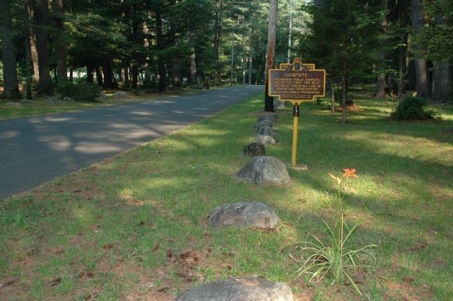
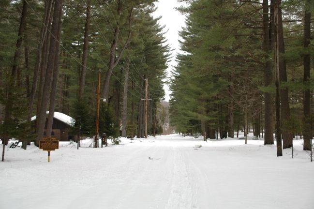
Location. 43° 21.571′ N, 74° 17.33′ W. Marker is in Wells, New York, in Hamilton County. Marker can be reached from State Highway 30. The marker is not visible from the state highway since it is posted beside the road within the campground. The marker is just beyond and opposite the caretaker's cottage in the campground. Touch for map. Marker is at or near this postal address: 1047 State Highway Route 30, Wells NY 12190, United States of America. Touch for directions.
Other nearby markers. At least 8 other markers are within 11 miles of this marker, measured as the crow flies. Peck's Farm (approx. 8.7 miles away); Tennantville (approx. 9.8 miles away); Gene Tunney Park (approx. 10 miles away); The Adirondacks (approx. 10.1 miles away); Parkville (approx. 10.4 miles away); First Town Hall (approx. 10˝ miles away); Site of Lake Pleasant House (approx. 10˝ miles away); Grace Methodist Episcopal Church (approx. 10˝ miles away).
Regarding Sacandaga Public Campsite. The Devil's Tombstone State campsite in the Catskill Forest Preserve is the other campsite referred to by the text on the marker.
Camping at the Sacandaga Campsite area was well established before development as a campground was begun in 1920. Known locally as "The Forks", it was a popular and well developed stop over camping site when limited traveling conditions required such areas. In 1923 it was considered as being the largest and best equipped of any of the campgrounds available at the time. Much of the campground was developed by the Civilian Conservation Corps during the 1930's, with modernization being made during the years afterward.
Also see . . . New York State Department of Environmental Conservation Sacandaga Campground. (Submitted on July 12, 2010, by Howard C. Ohlhous of Duanesburg, New York.)
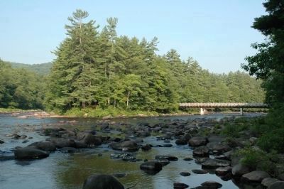
Photographed By Howard C. Ohlhous, July 7, 2010
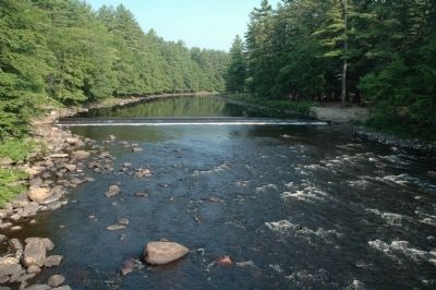
3. The Sacandaga River
Many of the individual campsites, and much of the day-use area is beside the beautiful Sacandaga River. The West Branch of the Sacandaga River, on the left, joins the Sacandaga River here at "The Forks". The bridge shown spanning the Sacandaga, on the right, provides access to campsites 61-119.
Credits. This page was last revised on June 16, 2016. It was originally submitted on July 12, 2010, by Howard C. Ohlhous of Duanesburg, New York. This page has been viewed 1,247 times since then and 35 times this year. Photos: 1, 2, 3, 4. submitted on July 12, 2010, by Howard C. Ohlhous of Duanesburg, New York. 5. submitted on March 14, 2011, by Howard C. Ohlhous of Duanesburg, New York. • Syd Whittle was the editor who published this page.
