Kodak in Sevier County, Tennessee — The American South (East South Central)
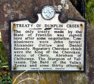
Treaty of Dumplin Creek
Erected by Tennessee Historical Commission.
Topics and series. This historical marker is listed in these topic lists: Native Americans • Peace • Wars, US Indian. In addition, it is included in the Tennessee Historical Commission series list.
Location. 35° 58.221′ N, 83° 37.65′ W. Marker is in Kodak, Tennessee, in Sevier County. Marker is on Treaty Road. Touch for map. Marker is at or near this postal address: 3649 Douglas Dam Road, Kodak TN 37764, United States of America. Touch for directions.
Other nearby markers. At least 8 other markers are within 5 miles of this marker, measured as the crow flies. Henry's Station (approx. 0.2 miles away); Major Hugh Henry (approx. 0.7 miles away); Dumplin Creek Treaty (approx. 1.3 miles away); The Great Indian Warpath (approx. 3.4 miles away); Jefferson County / Sevier County (approx. 3.4 miles away); The Kelly Family Farm (approx. 3.8 miles away); Steamboat Times on the French Broad (approx. 4 miles away); Wheatlands (approx. 4.2 miles away). Touch for a list and map of all markers in Kodak.
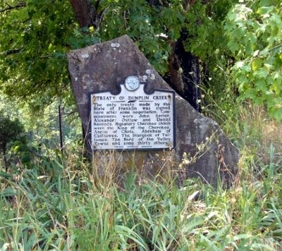
More about this marker. This beautiful spot is upland with view of the creek below. It is a short dead end gravel road in the middle of agricultural pastures. There are remnants of an old mill or store with some evidence of restoration in progress. It is a remarkable landmark in the early settlement of East Tennessee.
Additional commentary.
1. Marker Error
The Treaty of Dumplin Creek was not the only treaty between the State of Franklin and the Cherokees. The two also signed a treaty on August 3, 1786 - called the Treaty of Coyatee.
— Submitted September 15, 2010, by Wes Spurgeon of Piney Flats, Tennessee.
Credits. This page was last revised on December 17, 2019. It was originally submitted on July 18, 2010, by Donald Raby of Knoxville, Tennessee. This page has been viewed 2,601 times since then and 142 times this year. Photos: 1, 2, 3. submitted on July 18, 2010, by Donald Raby of Knoxville, Tennessee. • Bill Pfingsten was the editor who published this page.


