Sidney in Champaign County, Illinois — The American Midwest (Great Lakes)
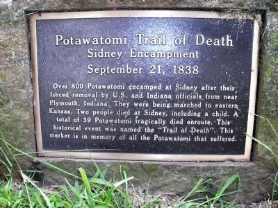
Potawatomi Trail of Death
Sidney Encampment
— September 21, 1838 —
Inscription.
Over 800 Potawatomi encamped at Sidney after their forced removal by U.S. and Indiana officials from near Plymouth, Indiana. They were being marched to eastern Kansas. Two people died at Sidney, including a child. A total of 39 Potawatomi tragically died enroute. This historical event was named the “Trail of Death”. This marker is in memory of all Potawatomi that suffered.
Erected 1991 by Boy Scout Andy Chase (Eagle Award).
Topics and series. This historical marker is listed in these topic lists: Native Americans • Notable Events • Notable Places. In addition, it is included in the Potawatomi Trail of Death series list.
Location. 40° 1.594′ N, 88° 3.883′ W. Marker is in Sidney, Illinois, in Champaign County. Marker is on Dunlap Woods north of East Main Street, on the right when traveling north. Touch for map. Marker is in this post office area: Sidney IL 61877, United States of America. Touch for directions.
Other nearby markers. At least 8 other markers are within 10 miles of this marker, measured as the crow flies. Lincoln at Kelley's Tavern (approx. 4.6 miles away); On The Bloomington Road / The Clark Neighborhood (approx. 5˝ miles away); Beginning of the Lincoln Circuit Trail (approx. 5˝ miles away); Site of German Lutheran Immanuel Church (approx. 7.1 miles away); Abraham Lincoln - Eighth Judicial District (approx. 7˝ miles away); Roger Ebert Residence (approx. 9.1 miles away); Former Site of Orizaba IL (approx. 9.2 miles away); DeWolf Residence (approx. 9.4 miles away).
Also see . . .
1. Trail of Death map. Kansas History/Potawatomi Web entry (Submitted on July 19, 2010, by Al Wolf of Veedersburg, Indiana.)
2. Potawatomi Trail of Death Association. Association official web-site (Submitted on July 19, 2010, by Al Wolf of Veedersburg, Indiana.)
Credits. This page was last revised on January 23, 2021. It was originally submitted on July 19, 2010, by Al Wolf of Veedersburg, Indiana. This page has been viewed 1,400 times since then and 39 times this year. Photos: 1, 2, 3, 4, 5, 6. submitted on July 19, 2010, by Al Wolf of Veedersburg, Indiana. • Syd Whittle was the editor who published this page.


