Fernandina Beach in Nassau County, Florida — The American South (South Atlantic)
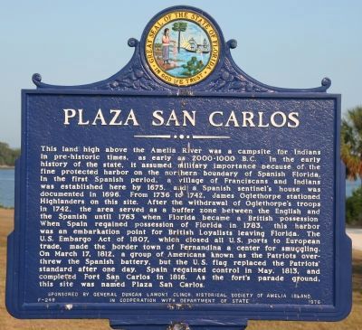
Plaza San Carlos
Erected 1976 by General Duncan Lamont Clinch Historical Society of Amelia Island in cooperation with Department of State. (Marker Number F-249.)
Topics. This historical marker is listed in these topic lists: Colonial Era • Native Americans • Settlements & Settlers. A significant historical month for this entry is March 1857.
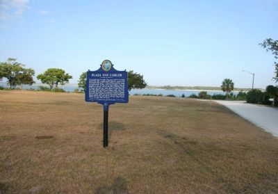
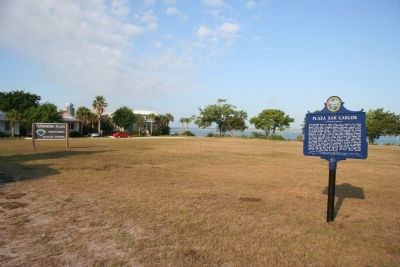
Location. 30° 41.306′ N, 81° 27.378′ W. Marker is in Fernandina Beach, Florida, in Nassau County. Marker is at the intersection of Estrada Street and Someruelus Street, on the right when traveling south on Estrada Street. This historical marker is located at the northeastern end of Amelia Island in Fernandina Plaza Historic State Park, which is situated along the Amelia River, near the confluence of the Amelia River with the St. Marys River. It is in this area that the St. Marys River marks Florida's northern boarder with Georgia. Touch for map. Marker is in this post office area: Fernandina Beach FL 32034, United States of America. Touch for directions.
Other nearby markers. At least 8 other markers are within walking distance of this marker. The UNESCO Slave Route Project: Resistance, Liberty, Heritage (within shouting distance of this marker); Fort San Carlos (within shouting distance of this marker); 6-Pound Cannon (within shouting distance of this marker); Shipwreck, Slavery and Survival (within shouting distance of this marker); Fort Clinch Military Road (within shouting distance of this marker); The Plaza (within
shouting distance of this marker); Old Town (approx. ¼ mile away); McClure's Hill (approx. 0.6 miles away). Touch for a list and map of all markers in Fernandina Beach.
Regarding Plaza San Carlos. It would seem that the Plaza San Carlos area is an important part of Amelia Island's rich and storied past. One of it's more unusual claims to fame is that there has been eight different flags hoisted above the Plaza San Carlos area, more, it is alleged, than any other location in the United States of America.
The eight different flags that have flown above Amelia’s shores are: French from 1562-1565; Spanish 1565-1763; British 1763-1783; Spanish (again) 1783-1821 with 3 interruptions — Patriots 1812, Green Cross of Florida 1817, Mexican Rebel Flag 1817; United States of America 1821 to present with one interruption — the Confederate Flag, 1862.
Also see . . . Fernandina Beach FL. This link provides historical information on Fernandina Beach, Florida, and discusses briefly the Plaza San Carlos. (Submitted on July 21, 2010, by Dale K. Benington of Toledo, Ohio.)
Additional commentary.
1. Pippi Longstocking House (aka Captain’s House or the Downes House).
Directly across the street and impossible to miss when passing through Old Town is the Captain’s House (also known as the "Downes House"). This historic home borders the Fernandina Plaza and can clearly be seen from the river boats passing by, with its high tower and gabled dormers. It’s also known as the “Pippi Longstocking” house since the late 1980s when the movie was filmed on location at the home. Note To Editor only visible by Contributor and editor
— Submitted August 9, 2017, by Mark Hilton of Montgomery, Alabama.
Credits. This page was last revised on October 28, 2020. It was originally submitted on July 20, 2010, by Dale K. Benington of Toledo, Ohio. This page has been viewed 1,189 times since then and 59 times this year. Photos: 1, 2, 3. submitted on July 21, 2010, by Dale K. Benington of Toledo, Ohio.


