Near Marietta in Cobb County, Georgia — The American South (South Atlantic)
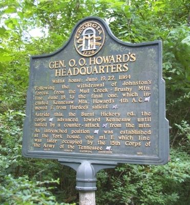
Gen. O. O. Howard’s Headquarters
Wallis House; June 19, 22, 1864
Astride this, the Burnt Hickory rd., the corps [US] advanced toward Kennesaw until halted by a counter-attack [CS] from the mtn. An intrenched position [US] was established at the York house, one mi. E. which line was later occupied by the 15th Corps of the Army of the Tennessee [US].
Erected 1953 by Georgia Historical Commission. (Marker Number 033-21.)
Topics and series. This historical marker is listed in these topic lists: Notable Buildings • War, US Civil. In addition, it is included in the Georgia Historical Society series list. A significant historical month for this entry is June 1926.
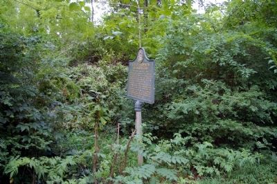
Location. 33° 57.805′ N, 84° 36.755′ W. Marker is near Marietta, Georgia, in Cobb County. Marker is on Burnt Hickory Road, 0.1 miles east of Ernest W. Barrett Parkway, on the right when traveling west. Touch for map. Marker is in this post office area: Marietta GA 30064, United States of America. Touch for directions.
Other nearby markers. At least 8 other markers are within one mile of this marker, measured as the crow flies. General Leonidas Polk's Headquarters (approx. 0.3 miles away); Hardee's Salient (approx. 0.7 miles away); Gen. J. E. Johnston’s Headquarters (approx. 0.7 miles away); Logan’s 15th A.C. Line (approx. one mile away); US Regulars Monument (approx. one mile away); Kennesaw Battlefield (approx. 1.1 miles away); Undercooks, Nurses, and Freedom (approx. 1.1 miles away); Assault on Pigeon Hill (approx. 1.1 miles away). Touch for a list and map of all markers in Marietta.
Additional commentary.
1. Grandfather's home
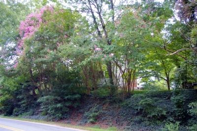
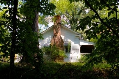
It may or not be of interest to others concerning some later back-story concerning this home and property. My grandfather purchased the home back into the family at some time in the 40-50s. At the time of the purchase there were still doors inside the home with damage from a small skirmish fought on the property and within the home itself. Many floor boards were missing, and the house was in a general state of disrepair. The home was used as a field hospital just before or just after the Gen. moved on, and the property across the Burnt Hickory Road was used as a field cemetery. In the 50s work was undertaken to exhume those bodies, as well as parts and pieces that were amputated from victims of the warfare and found in the crawlspace of the home. Those bodies/parts found were interred in the Confederate Cemetery in Marietta.
It was not uncommon at all during the 60s and on for my grandfather to have to chase off relic seekers from the property surrounding the house, which was lined with trenches and earthworks. There were many fine relics unearthed there and many of them can be found at the Big Shanty Museum in Kennesaw, GA.
The home being on the Historical Register was the work of one of my uncles in an effort to make sure that the home was preserved into the future. After the death of my grandfather the home and property were sold to a land developer, the last, largest tract of undeveloped land in West Cobb not in the inventory of land owned by the Park Dept. Unfortunately the property was developed and the trenches and earthworks are now lost to history. Fortunately due to the actions of my uncle the home cannot be torn down without consequence and will be there into perpetuity for others to enjoy, slated to be used as a community center for the neighborhood that is now in place.
The current home layout is the result of an add-on my grandfather made. The "back" porch area was made into another room, and the bathroom was added on as a modern convenience, along with running water. Prior to that, the original spot for the Civil War-era outhouse was still in use,
although not the same building, and the original well is still located just off the south wall.
— Submitted May 24, 2011, by Martin jordan of McDonough, Georgia.
Credits. This page was last revised on May 28, 2020. It was originally submitted on July 22, 2010, by David Seibert of Sandy Springs, Georgia. This page has been viewed 1,381 times since then and 23 times this year. Photos: 1, 2, 3, 4. submitted on July 22, 2010, by David Seibert of Sandy Springs, Georgia. • Craig Swain was the editor who published this page.


