Benevolence in Randolph County, Georgia — The American South (South Atlantic)
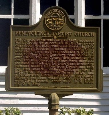
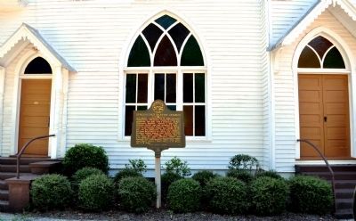
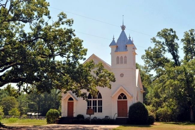
Benevolence Baptist Church
Erected 1955 by Georgia Historical Commission. (Marker Number 120-11.)
Topics and series. This historical marker is listed in these topic lists: Churches & Religion • Settlements & Settlers. In addition, it is included in the Georgia Historical Society series list. A significant historical date for this entry is May 16, 1779.
Location. 31° 52.9′ N, 84° 44.083′ W. Marker is in Benevolence, Georgia, in Randolph County. Marker is at the intersection of Cuthbert Road (County Route 156) and Lumpkin Road (County Route 104), on the right when traveling north on Cuthbert Road. Marker is set back from road, right in front of the church. Touch for map. Marker is in this post office area: Cuthbert GA 39840, United States of America. Touch for directions.
Other nearby markers. At least 8 other markers are within 9 miles of this marker, measured as the crow flies. First Seat of Government of Randolph County (approx. 4.7 miles away); Mother of Georgia's Pecan Industry (approx. 8.1 miles away); Randolph County (approx. 8.2 miles away); The Second Creek War in Randolph County (approx. 8.2 miles away); The City of Cuthbert and Early Randolph County (approx. 8.2 miles away); Site of First Church Building in Cuthbert, Georgia (approx. 8.2 miles away); Frederick Davis Patterson, M.D. / Patterson Hospital (approx. 8.2 miles away); Old Carnegie Library (approx. 8.3 miles away).
Credits. This page was last revised on February 1, 2020. It was originally submitted on October 24, 2008, by David Seibert of Sandy Springs, Georgia. This page has been viewed 1,403 times since then and 26 times this year. Last updated on July 25, 2010, by Ed Ward of Alexandria, Virginia. Photos: 1. submitted on October 24, 2008, by David Seibert of Sandy Springs, Georgia. 2, 3. submitted on November 1, 2011, by David Seibert of Sandy Springs, Georgia. • Craig Swain was the editor who published this page.


