Lancaster in Worcester County, Massachusetts — The American Northeast (New England)
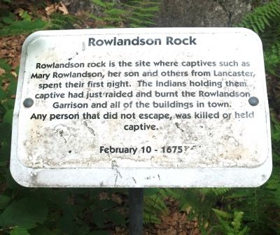
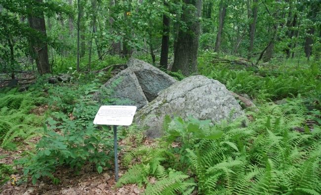
Rowlandson Rock
Any person that did not escape, was killed or held captive.
Topics. This historical marker is listed in these topic lists: Colonial Era • Native Americans • Wars, US Indian • Women. A significant historical date for this entry is February 10, 1854.
Location. 42° 26.727′ N, 71° 42.02′ W. Marker is in Lancaster, Massachusetts, in Worcester County. Marker is deep in the woods, about 400 feet north of two large water towers at the end of Winsor Road, off George Hill Road. Touch for map. Marker is in this post office area: Lancaster MA 01523, United States of America. Touch for directions.
Other nearby markers. At least 8 other markers are within 3 miles of this marker, measured as the crow flies. A different marker also named Rowlandson Rock (approx. ¾ mile away); Lancaster (approx. 0.9 miles away); Sawyer-Carter Bridge (approx. 1.1 miles away); Site of Mary Rowlandson’s Capture (approx. 1.3 miles away); Site of the Great Elm (approx. 1.7 miles away); Prescott Grist Mill (approx. 1.8 miles away); Neck Bridge (approx. 1.9 miles away); Mary Sawyer’s Birthplace (approx. 2.1 miles away). Touch for a list and map of all markers in Lancaster.
Regarding Rowlandson Rock. On February 10, 1675/6, during King Philip’s War, Indian raiders led by Nipmuc sachem Monoco attacked Lancaster, MA, and carried off 24 hostages. One was Mary Rowlandson, the minister’s wife, who later wrote a detailed narrative of her ordeal. (The year was written as 1675 in colonial times, when each new year was considered to begin in March, but today we would call it 1676.)
Several other markers in central Massachusetts identify further sites to which Mary Rowlandson was moved during her 82 days of captivity.
Also see . . . Wikipedia entry for Mary Rowlandson. More about Mary Rowlandson. (Submitted on July 25, 2010, by Roger W. Sinnott of Chelmsford, Massachusetts.)

Internet Archive
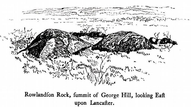
3. Rowlandſon Rock,
ſummit of George Hill,
looking East upon Lancaſter,
ſummit of George Hill,
looking East upon Lancaſter,
From The Narrative of the Captivity and Restoration of Mrs. Mary Rowlandson, First Printed in 1682 at Cambridge, Massachusetts, & London, England. Reprinted in facsimile, 1903 published by J. Wilson Cambridge and Son.
Credits. This page was last revised on November 21, 2020. It was originally submitted on July 25, 2010, by Roger W. Sinnott of Chelmsford, Massachusetts. This page has been viewed 2,051 times since then and 57 times this year. Photos: 1, 2. submitted on July 25, 2010, by Roger W. Sinnott of Chelmsford, Massachusetts. 3. submitted on November 11, 2020, by Allen C. Browne of Silver Spring, Maryland. • Kevin W. was the editor who published this page.

