Ninety Six in Greenwood County, South Carolina — The American South (South Atlantic)
Early Life in the Backcountry
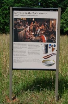
Gouedy's Trading Post and Fort Ninety Six
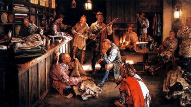
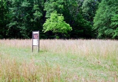
Robert Gouedy established a trading post on this site in 1753. He supplied cloth, tools, gunpowder, lead, and rum to the soldiers, Indians, slaves, and settlers who passed through Ninety Six on the way to or from Charleston and the Cherokee villages. Representatives of the British colonial government often came through here, as well.
As the backcountry population grew, so did violence between settlers and Indians. Indian attacks were often precipitated by the French, trying to wrest South Carolina from British control. In October 1759, British Governor Lyttleton formed a militia to protect settlers against Indian attacks. He searched for "a proper Place to build a Magazine and Stockade Fort." At the crossroads of Ninety Six, he found Gouedy's post. Lyttleton commandeered Gouedy's house, barn, and outbuildings, enclosed them in a 90-foot-square stockade, and garrisoned his militia. Renamed Fort Ninety Six, this was the site of at least two dramatic Indian attacks in 1760.
By the end of 1761 the British and Cherokee negotiated a truce. As the town of Ninety Six developed near the Island Ford Road, Fort Ninety Six was abandoned and all traces of it disappeared. Gouedy prospered, eventually owning over 1,500 acres of land in Ninety Six and 34 slaves until his death in 1775.
An account of the March 3, 1760 attack appeared in the South Carolina Gazette:
...about 240 or 250 Indians attacked the Fort...and fired upon it for 36 Hours, without scarce any Intermission, even during the whole Night, but never came within 60 yards of the Stockade, except one fellow, who was killed and scalped, and whose body was given to the Dogs, and his Scalp hoisted along-side of the Colours, to provoke the Enemy to come nearer.
Erected 2009 by National Park Service.
Topics. This historical marker is listed in these topic lists: Exploration • Forts and Castles • Native Americans • Settlements & Settlers • War, French and Indian. A significant historical date for this entry is March 3, 1760.
Location. 34° 8.373′ N, 82° 1.083′ W. Marker is in Ninety Six, South Carolina, in Greenwood County. Marker can be reached from South Cambridge Street (State Highway 248). Touch for map. Marker is in this post office area: Ninety Six SC 29666, United States of America. Touch for directions.
Other nearby markers. At least 10 other markers are within walking distance of this marker. Gouedy Trail and Charleston Road (approx. 0.3 miles away); Why Did the British Burn Ninety Six? (approx. 0.4 miles away); Law and Order in the Carolina Backcountry (approx. 0.4 miles away); The American Revolution Comes to the South (approx. 0.4 miles away); Woman and Child (approx. 0.4 miles away); Spring Branch (approx. 0.4 miles away); Ninety Six (approx. 0.4 miles away); Covered Way (approx. 0.4 miles away); The Star Fort (approx. 0.4 miles away); The Well (approx. half a mile away). Touch for a list and map of all markers in Ninety Six.
Also see . . .
1. The Gowdy Family in South Carolina - Robert Gouedy. No one is certain how the village Ninety Six got its name. (Submitted on July 26, 2010, by Brian Scott of Anderson, South Carolina.)
2. French and Indian War. The French and Indian War is the common U.S. name for the war between Great Britain and France in North America from 1754 to 1763 (Submitted on July 26, 2010, by Brian Scott of Anderson, South Carolina.)
3. William Lyttelton, 1st Baron Lyttelton. William Henry Lyttelton, 1st Baron Lyttelton (24 December 1724 – 14 September 1808) was the youngest son of Sir Thomas Lyttelton, 4th Baronet. (Submitted on July 26, 2010, by Brian Scott of Anderson, South Carolina.)
Credits. This page was last revised on November 19, 2020. It was originally submitted on July 25, 2010, by Brian Scott of Anderson, South Carolina. This page has been viewed 1,150 times since then and 24 times this year. Photos: 1, 2, 3, 4, 5, 6, 7. submitted on July 25, 2010, by Brian Scott of Anderson, South Carolina.
