Near Gila River in Pinal county, Arizona — The American Mountains (Southwest)
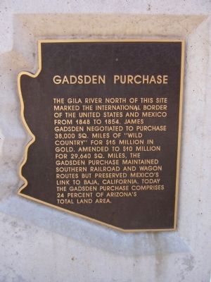
Gadsden Purchase
Topics. This historical marker is listed in these topic lists: Notable Events • Notable Places • War, Mexican-American. A significant historical year for this entry is 1848.
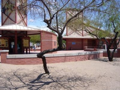
Location. 33° 2.509′ N, 111° 47.101′ W. Marker is near Gila River in Pinal county, Arizona. Marker can be reached from Interstate 10 at milepost 181. Marker is located at the eastbound rest area. Touch for map. Marker is in this post office area: Casa Grande AZ 85122, United States of America. Touch for directions.
Other nearby markers. At least 8 other markers are within 7 miles of this marker, measured as the crow flies. Gila River Indian Reservation (here, next to this marker); a different marker also named Gila River Indian Reservation (approx. 1.2 miles away); a different marker also named Gadsden Purchase (approx. 1.2 miles away); Dedicated to Ira H. Hayes USMC (approx. 3˝ miles away); Honoring Native American Women Veterans (approx. 3˝ miles away); Dedicated to the Memory of Matthew B. Juan (approx. 3˝ miles away); Military Order Purple Heart of the U.S.A. (approx. 3.6 miles away); Gila River Internment Center - Rivers, Arizona (approx. 6˝ miles away). Touch for a list and map of all markers in Gila River.
More about this marker. There is an identical marker to this marker about 100 feet to the left of this marker.
Credits. This page was last revised on June 16, 2016. It was originally submitted on July 28, 2010, by Bill Kirchner of Tucson, Arizona. This page has been viewed 1,958 times since then and 64 times this year. Photos: 1, 2, 3. submitted on July 28, 2010, by Bill Kirchner of Tucson, Arizona. • Syd Whittle was the editor who published this page.


