Near Refugio in Refugio County, Texas — The American South (West South Central)
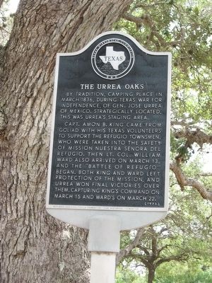
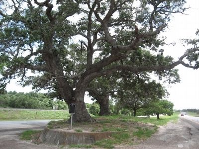
The Urrea Oaks
Erected 1973 by Texas Historical Commission. (Marker Number 5616.)
Topics. This historical marker is listed in this topic list: War, Texas Independence. A significant month for this entry is March.
Location. Marker has been reported missing. It was located near 28° 17.188′ N, 97° 17.291′ W. Marker was near Refugio, Texas, in Refugio County. Marker was on U.S. 77, on the left when traveling south. One mile south of Refugio. Touch for map. Marker was in this post office area: Refugio TX 78377, United States of America. Touch for directions.
Other nearby markers. At least 8 other markers are within one mile of this location, measured as the crow flies. Our Lady of Refuge Catholic Church (approx. 0.8 miles away); Site of Mission Nuestra Señora del Refugio (approx. 0.8 miles away); Yucatan Soldiers' Burial Site (approx. 0.9 miles away); Dennis M. O'Connor Public Library (approx. one mile away); Sally Scull (approx. one mile away); Empresario James Power (approx. one mile away); Refugio County (approx. one mile away); Refugio County Courthouses (approx. one mile away). Touch for a list and map of all markers in Refugio.
Additional commentary.
1. Marker destroyed by Hurricane Harvey will now be replaced.
In August of 2017 this marker was blown away by Hurricane Harvey. The Refugio County Historical Commission approved a replacement marker on January 22, 2019.
— Submitted January 23, 2019, by Mark Hilton of Montgomery, Alabama.
Credits. This page was last revised on February 2, 2019. It was originally submitted on July 28, 2010, by Steve Gustafson of Lufkin, Texas. This page has been viewed 3,161 times since then and 192 times this year. Photos: 1, 2. submitted on July 28, 2010, by Steve Gustafson of Lufkin, Texas. • Craig Swain was the editor who published this page.

