Wharton Township near Farmington in Fayette County, Pennsylvania — The American Northeast (Mid-Atlantic)
Road to Disaster
Fort Necessity National Battlefield
— National Park Service, U.S. Department of the Interior —
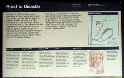
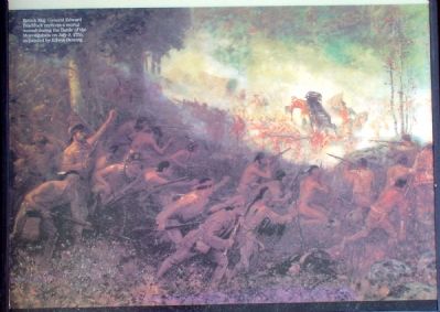
On June 25, 1755, the largest army assembled in North America up to that time passed this spot. British Maj. Gen. Edward Braddock led the first 1,400 soldiers of his 2,400-man army along a 12-foot-wide road. Lt. Col. Thomas Dunbar lagged behind with 1,000 men and the army's supplies. Braddock's goal of expelling the French from Fort Duquesne (present-day Pittsburgh) was thwarted when his advance troops collided with a force of French and Indians.
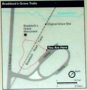
On July 14, what remained of that once proud British army hobbled past this point, retreating from their disastrous defeat at the Battle of the Monongahela. Today, the trail leads to this remnant of the "Braddock Road" where a British army marched toward battle, returned in defeat, and buried its fallen leader.
Erected by National Park Service, U.S. Department of the Interior.
Topics and series. This historical marker is listed in these topic lists: Colonial Era • War, French and Indian. In addition, it is included in the Braddock’s Road and Maj. Gen. Edward Braddock series list. A significant historical date for this entry is June 25, 1755.
Location. 39° 49.95′ N, 79° 36.027′ W. Marker is near Farmington, Pennsylvania, in Fayette County. It is in Wharton Township. Marker can be reached from National Pike (U.S. 40) 1.2 miles east of Fayette Springs Road. Touch for map. Marker is in this post office area: Farmington PA 15437, United States of America. Touch for directions.
Other nearby markers. At least 5 other markers are within walking distance of this marker. A Secret Grave (within shouting distance of this marker); The Old Braddock Road (within shouting distance of this marker); First Roads to the West (within shouting distance of this marker); Braddock’s Grave (within shouting distance of this marker); Braddock Park (within shouting distance of this marker). Touch for a list and map of all markers in Farmington.
Additional commentary.
1. Time Line from the Marker
April 1754 — Lt. Col. George Washington marches northwest from Alexandria, Virginia to the frontier with 132 Virginia militia under orders from Virginia Lt. Gov. Robert Dinwiddie. Washington's mission is to occupy and defend the Upper Ohio Valley against a French force advancing south from Canada.
May 28, 1754 — Ensign Joseph Coulon de Jumonville and 31 French troops skirmish with 40 Virginia militia under Washington and about 12 Indians. Ten French are killed, including Jumonville, and 21 are captured, including one wounded. One man escapes and reports the attack, to become known as the "Jumonville Affair."
July 3, 1754 — About 600 French and 100 Indians under Captain Louis Coulon de Villiers, Jumonville's brother, surround Washington's command of almost 400 British at Fort Necessity.
After a day of fighting, the British surrender and are allowed to march away; the French burn Fort Necessity on July 4.
1755 — Maj. General Edward Braddock leads about 2,400 British troops, including 400 colonial militia from Alexandria, Virginia to expel the French from Fort Duquesne. His troops improve Washington's road of 1754 and extend it to the Monongahela River near present-day Pittsburgh.
July 9, 1755 — Braddock's army is defeated by the French and their Indians allies at the Battle of Monongahela near Fort Duquesne. Braddock is mortally wounded and dies on July 13 during the British retreat. He is buried in the middle of "Braddock's Road" about one mile west of Fort Necessity.
— Submitted May 7, 2006.
Credits. This page was last revised on February 7, 2023. It was originally submitted on May 7, 2006, by J. J. Prats of Powell, Ohio. This page has been viewed 2,714 times since then and 17 times this year. Photos: 1, 2, 3, 4. submitted on May 7, 2006, by J. J. Prats of Powell, Ohio.


