Near Vinemont in Cullman County, Alabama — The American South (East South Central)
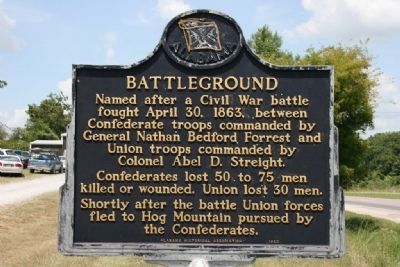
Battleground
Erected 1983 by Alabama Historical Association.
Topics and series. This historical marker is listed in this topic list: War, US Civil. In addition, it is included in the Alabama Historical Association series list. A significant historical date for this entry is April 30, 1991.
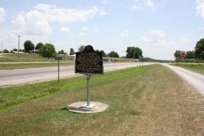
Location. 34° 18.217′ N, 86° 59.8′ W. Marker is near Vinemont, Alabama, in Cullman County. Marker is at the intersection of State Highway 157 and County Road 1101, on the right when traveling south on State Highway 157. Touch for map. Marker is in this post office area: Vinemont AL 35179, United States of America. Touch for directions.
Other nearby markers. At least 8 other markers are within 7 miles of this marker, measured as the crow flies. The "Katy-Did" Crash (approx. 1˝ miles away); Cedar Plains Christian Church (approx. 4.2 miles away); McKendree Cemetery and the Massey Community / Charles Christopher Sheats 1839-1904 (approx. 4.8 miles away); Battle of Day’s Gap (approx. 5.9 miles away); Streight’s Raid (approx. 6.6 miles away); a different marker also named Streight’s Raid (approx. 6.6 miles away); Birds of Alabama (approx. 6.7 miles away); Where does your drinking water come from? (approx. 6.7 miles away). Touch for a list and map of all markers in Vinemont.
Credits. This page was last revised on January 23, 2017. It was originally submitted on August 1, 2010, by Timothy Carr of Birmingham, Alabama. This page has been viewed 2,720 times since then and 114 times this year. Photos: 1, 2. submitted on August 1, 2010, by Timothy Carr of Birmingham, Alabama. • Craig Swain was the editor who published this page.

