Kinston in Lenoir County, North Carolina — The American South (South Atlantic)
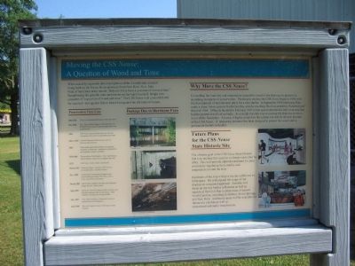
Moving the CSS Neuse
A Question of Wood and Time
Preservation Time Line
1961-1963 Three local businessmen recover the CSS Neuse.
Nov. 1963 Gov. Terry Sanford approves the allocation of $10,000 for moving the ship and applying wood preservatives.
1964 CSS Neuse removed from recovery site and relocated to Governor Caswell Memorial Park.
July 1, 1965 Caswell Memorial Park becomes part of Historic Sites Section.
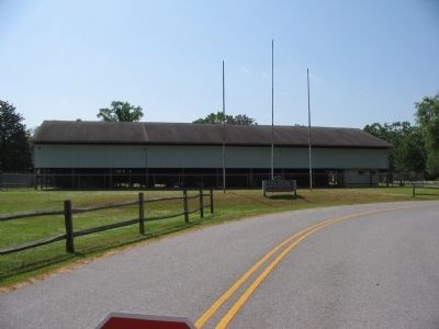
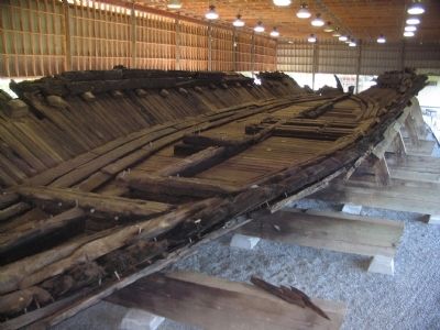
1969 State builds open-sided shelter over gunboat to protect it from rain; windblown precipitation and humidity remain a problem.
1970-1998 Preservation of hull begins. Care, maintenance, and protection carried out at regular intervals.
1972 CSS Neuse visitor center constructed.
March 1993 Planning begins to enclose CSS Neuse in environmentally controlled facility.
Nov. 1995 Conservation Assessment Program team recommends providing CSS Neuse with a more controlled environment.
March 1996 East Group completes site plan and schematic design for new visitor center.
Sept. 1996 Hurricane Fran hits eastern North Carolina and flooding damages hull of CSS Neuse. State rethinks enclosing the existing shelter.
Feb. 1997 State repair funding is redirected to remove gunboat from the floodplain.
April 1998 Site work begins to move CSS Neuse to new location.
Why Move the CSS Neuse?
Controlling the humidity and temperature around the vessel is the best way to preserve it, according to experts in conservation. Planning to enclose the CSS Neuse began in 1993 with the development of architectural plans for a new shelter. In September 1996 Hurricane Fran made a direct hit on eastern North Carolina, and the resulting flood exceeded the "hundred-year" flood of 1964. Officials decided in February 1997 not to spend substantial funds in an area that had the potential to flood so badly. As a result, the only way to enclose the ship was to move it out of the floodplain. An area of higher ground on the current site will be the new location of the CSS Neuse. A temporary structure has been designed to protect the vessel until a permanent facility is funded.
Future Plans for the CSS Neuse State Historic Site
The ultimate goal at the CSS Neuse State Historic Site is to enclose the vessel in a climate-controlled facility. This will provide optimal conditions for preservation by regulating the humidity and temperature around the ship.
Enclosures of the ship will give the site additional exhibit space. We will expand the scope of our displays to a regional approach. Exhibits will focus on the two battles in Kinston as well as aspects of the Civil War in other areas of eastern North Carolina, including Goldsboro, Seven Springs, and New Bern. Additional space will be available for interactive exhibits as well as education and audio visual rooms.
Topics. This historical marker is listed in these topic lists: War, US Civil • Waterways & Vessels. A significant historical month for this entry is February 1997.
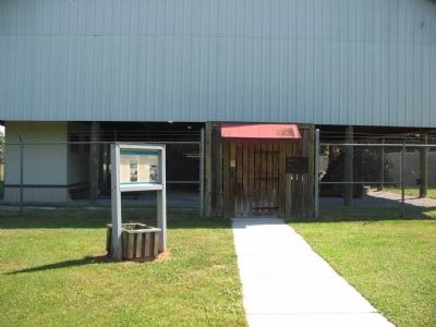
Location. 35° 16.034′ N, 77° 37.273′ W. Marker is in Kinston, North Carolina, in Lenoir County. Marker is at the intersection of Richard Caswell Grave Road and West Vernon Avenue (U.S. 70/258), on the right when traveling east on Richard Caswell Grave Road. Located in the CSS Neuse and Caswell State Historic Site. Touch for map. Marker is in this post office area: Kinston NC 28504, United States of America. Touch for directions.
Other nearby markers. At least 8 other markers are within 3 miles of this marker, measured as the crow flies. Grave of Richard Caswell (about 400 feet away, measured in a direct line); Richard Caswell (about 500 feet away); Walk of Honor Memorial (approx. 2.2 miles away); Cat Hole (approx. 2.2 miles away); CSS Neuse Confederate Ironclad Gunboat (approx. 2.2 miles away); Birth of Funk (approx. 2.3 miles away); Kinston Sit-Ins (approx. 2.3 miles away); CSS Neuse (approx. 2.3 miles away). Touch for a list and map of all markers in Kinston.
More about this marker. On the left side of the marker are photos of damage done by the floods following Hurricane Fran. On the right side are artist depictions of the planned facility.
Additional keywords. Preservation
Credits. This page was last revised on June 16, 2016. It was originally submitted on August 1, 2010, by Craig Swain of Leesburg, Virginia. This page has been viewed 1,992 times since then and 23 times this year. Photos: 1, 2, 3, 4. submitted on August 1, 2010, by Craig Swain of Leesburg, Virginia.


