Burlington in Burlington County, New Jersey — The American Northeast (Mid-Atlantic)
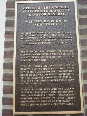
Office of the Council of Proprietors and the Surveyor General
Western Division of New Jersey
Inscription.
Founded at London in 1675 by William Penn and Quaker trustees, the proprietors of West Jersey sold shares in land that resulted in rapid development of Burlington starting in 1677.
The council was formed in 1688 to manage the growing demand for land in West Jersey, and has met annually in May since that time.
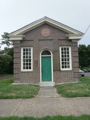
This 1911 brick building replaced a nearby old wooden building. It is within the Burlington Historic District and is listed as a contributing building on the National Register of Historic Places by the United States Department of the Interior.
In 1676 William Penn and the Quaker trustees published the Concessions and Agreements that guaranteed freedoms and rights to West Jersey emigrants and became the inspiration to our founding fathers a century later.
Topics and series. This historical marker is listed in these topic lists: Colonial Era • Government & Politics • Settlements & Settlers. In addition, it is included in the Quakerism series list. A significant historical year for this entry is 1675.
Location. 40° 4.645′ N, 74° 51.602′ W. Marker is in Burlington, New Jersey, in Burlington County. Marker is on West Broad Street, 0.1 miles west of High Street, on the right when traveling west. Touch for map. Marker is in this post office area: Burlington NJ 08016, United States of America. Touch for directions.
Other nearby markers. At least 8 other markers are within walking distance of this marker. Grant House (within shouting distance of this marker); Old St. Mary's - 1702 (within shouting distance of this marker); Pre-Revolutionary History of Burlington City (within shouting distance of this marker); Old St. Mary's Church (within shouting distance of this marker); Old St. Mary’s (about 300 feet away, measured in a direct line); Ockanickon (about 300 feet away); Founding of St. Mary’s Parish (about 400 feet away); New St. Mary’s (about 500 feet away). Touch for a list and map of all markers in Burlington.
Also see . . . West Jersey. Wikipedia entry (Submitted on August 2, 2010, by Deb Hartshorn of Burlington County, New Jersey.)

Photographed By Deb Hartshorn, August 1, 2010
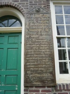
2. The Concessions and Agreements
1682
The Concessions and Agreements of the Proprietors, Freeholders and Inhabitants of the province of West New Jersey in America.
In testimony and witness of our consent to and affirmation of these present Laws Concessions and Agreements. We the Proprietors Freeholders and Inhabitants of the said Province of West New Jersey whole names are under written have to the same voluntarily and freely set our hands dated this third day of of the month commonly called March in the yeare of our Lord one thousand six hundred seaventy six.
Erected by the New Jersey Society of Pennsylvania June 7, 1919
Credits. This page was last revised on October 8, 2021. It was originally submitted on August 1, 2010, by Deb Hartshorn of Burlington County, New Jersey. This page has been viewed 1,043 times since then and 31 times this year. Photos: 1. submitted on August 1, 2010, by Deb Hartshorn of Burlington County, New Jersey. 2, 3. submitted on August 2, 2010, by Deb Hartshorn of Burlington County, New Jersey. • Bill Pfingsten was the editor who published this page.

