Downtown in Hampton, Virginia — The American South (Mid-Atlantic)
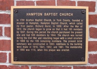
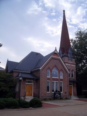
Hampton Baptist Church
Erected 1990.
Topics. This historical marker is listed in these topic lists: Churches & Religion • Colonial Era • War, US Civil. A significant historical year for this entry is 1791.
Location. 37° 1.601′ N, 76° 20.663′ W. Marker is in Hampton, Virginia. It is in Downtown. Marker is on Kings Way, 0.1 miles south of Lincoln Street, on the left when traveling south. Touch for map. Marker is at or near this postal address: 40 Kings Way, Hampton VA 23669, United States of America. Touch for directions.
Other nearby markers. At least 8 other markers are within walking distance of this marker. Hampton Courthouse (a few steps from this marker); The Courthouse (within shouting distance of this marker); King and Queen Streets (about 300 feet away, measured in a direct line); The Northeast Corner (about 300 feet away); The Sclater Building (about 300 feet away); F.W. Woolworth Co. Building (about 300 feet away); The Southwest Corner (about 400 feet away); The Southeast Corner (about 400 feet away). Touch for a list and map of all markers in Hampton.
Regarding Hampton Baptist Church. Excerpt from the Hampton Baptist Church website.
...In summer 1861, Confederate troops burned the City of Hampton rather than allowing it to fall into the hands of Union forces. Included in the destruction was the loss of Hampton Baptist Church's meeting place and its records. A witness reported:
The church was burning like a furnace and the flames were belching out of its steeple like an inferno… it seemed as if hell itself had broken lose and all its fiery demons were pouring oil on the flames.
In the aftermath of this disaster, Pastor George Adams became a chaplain in the Confederate Army, but continued to shepherd the remnant of his flock until 1862, when Union forces arrested him as a spy. With their pastor imprisoned on the Rip Raps in Hampton Roads, and the congregation scattered by the forces of conflict, the church reached a new low point in its life. ...
Also see . . . Historical Highlights of Hampton Baptist Church. (Submitted on August 2, 2010, by Bernard Fisher of Richmond, Virginia.)
Credits. This page was last revised on February 1, 2023. It was originally submitted on August 2, 2010, by Bernard Fisher of Richmond, Virginia. This page has been viewed 878 times since then and 36 times this year. Photos: 1, 2. submitted on August 2, 2010, by Bernard Fisher of Richmond, Virginia.

