South Newport News , Virginia — The American South (Mid-Atlantic)
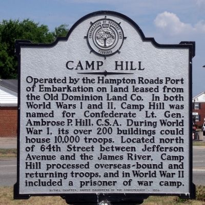
Camp Hill
Erected 1984 by Bethel Chapter, United Daughters of the Confederacy.
Topics and series. This historical marker is listed in these topic lists: War, US Civil • War, World I • War, World II. In addition, it is included in the United Daughters of the Confederacy, and the Virginia, Corporation of Newport News series lists.
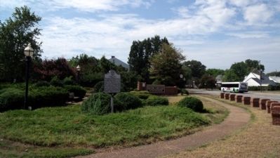
Location. 37° 0.626′ N, 76° 26.766′ W. Marker is in Newport News, Virginia. It is in South Newport News. Marker is at the intersection of Warwick Boulevard (U.S. 60) and Huntington Avenue, in the median on Warwick Boulevard. Touch for map. Marker is at or near this postal address: 6940 Huntington Avenue, Newport News VA 23607, United States of America. Touch for directions.
Other nearby markers. At least 8 other markers are within walking distance of this marker. Camp Alexander (approx. half a mile away); Consolidation (approx. half a mile away); Heading Out (approx. 0.7 miles away); Ferguson Park (approx. 0.7 miles away); Lake Biggins (approx. 0.7 miles away); 21 cm Mörser (approx. ¾ mile away); a different marker also named Ferguson Park (approx. ¾ mile away); M53 Self Propelled Gun (approx. ¾ mile away). Touch for a list and map of all markers in Newport News.
Also see . . . North End Historic District. National Register of Historic Places (Submitted on August 3, 2010.)
Credits. This page was last revised on February 1, 2023. It was originally submitted on August 3, 2010, by Bernard Fisher of Richmond, Virginia. This page has been viewed 1,534 times since then and 142 times this year. Photos: 1, 2. submitted on August 3, 2010, by Bernard Fisher of Richmond, Virginia.

