Near Apache Junction in Pinal County, Arizona — The American Mountains (Southwest)
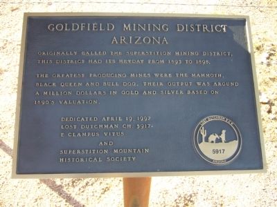
Goldfield Mining District
Arizona
The greatest producing mines were the Mammoth, Black Queen and Bull Dog. Their output was around a million dollars in gold and silver based on 1890's valuation.
Erected 1997 by Lost Dutchman Ch. 5917, E Clampus Vitus and Superstition Mountain Historical Society.
Topics and series. This historical marker is listed in this topic list: Natural Resources. In addition, it is included in the E Clampus Vitus series list. A significant historical year for this entry is 1893.
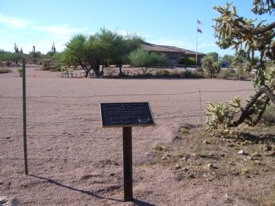
Location. 33° 26.841′ N, 111° 30.132′ W. Marker is near Apache Junction, Arizona, in Pinal County. Marker is on East Apache Trail (Arizona Route 88 at milepost 199) east of North Mountain View Road, on the right when traveling east. Touch for map. Marker is at or near this postal address: 4087 East Apache Trail, Apache Junction AZ 85119, United States of America. Touch for directions.
Other nearby markers. At least 8 other markers are within 9 miles of this marker, measured as the crow flies. Superstition Mountain Historical Society (a few steps from this marker); Ghost Town of Goldfield (approx. 1.1 miles away); Bluebird Mine and Gift Shop (approx. 1.1 miles away); a different marker also named Goldfield Mining District (approx. 1.1 miles away); Apache Trail (approx. 3.3 miles away); Jacob Von Walzer (approx. 3½ miles away); Canyon Lake (approx. 7.2 miles away); The Dutchman’s Inn (approx. 8½ miles away). Touch for a list and map of all markers in Apache Junction.
Credits. This page was last revised on June 16, 2016. It was originally submitted on August 5, 2010, by Bill Kirchner of Tucson, Arizona. This page has been viewed 1,546 times since then and 43 times this year. Photos: 1, 2, 3. submitted on August 5, 2010, by Bill Kirchner of Tucson, Arizona. • Syd Whittle was the editor who published this page.


