Near Apache Junction in Maricopa County, Arizona — The American Mountains (Southwest)
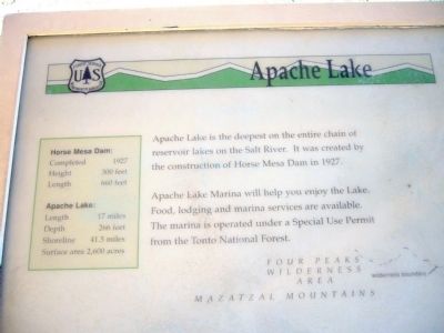
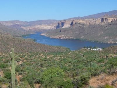
Apache Lake
Apache Lake Marina will help you enjoy the Lake. Food, lodging and marina services are available. The marina is operated under a Special Use Permit from the Tonto National Forest.
Inset:
Horse Mesa Dam:
Completed - 1927
Height - 300 feet
Length - 660 feet
Apache Lake:
Length - 17 miles
Depth - 266 feet
Shoreline - 41.5 miles
Surface area - 2,600 acres
Erected by Tonto National Forest.
Topics. This historical marker is listed in this topic list: Natural Resources. A significant historical year for this entry is 1927.
Location. 33° 33.836′ N, 111° 14.434′ W. Marker is near Apache Junction, Arizona, in Maricopa County. Marker is on Arizona Route 88 at milepost 229, on the left when traveling east. Touch for map. Marker is in this post office area: Apache Junction AZ 85119, United States of America. Touch for directions.
Other nearby markers. At least 8 other markers are within 9 miles of this marker, measured as the crow flies. Alchesay (approx. 8˝ miles away); The People Who Made It Happen (approx. 8˝ miles away); Roosevelt Dam (approx. 8˝ miles away); a different marker also named Roosevelt Dam (approx. 8˝ miles away); Welcome to the Apache Trail Historic Road (approx. 8˝ miles away); Salt River Before the Dam (approx. 8.8 miles away); Tonto Basin (approx. 8.8 miles away); The Bridge (approx. 8.8 miles away). Touch for a list and map of all markers in Apache Junction.
Credits. This page was last revised on June 16, 2016. It was originally submitted on August 5, 2010, by Bill Kirchner of Tucson, Arizona. This page has been viewed 1,269 times since then and 41 times this year. Photos: 1, 2, 3, 4. submitted on August 5, 2010, by Bill Kirchner of Tucson, Arizona. • Syd Whittle was the editor who published this page.
Editor’s want-list for this marker. Photo of the dam. • Can you help?


