Sturgis in Meade County, South Dakota — The American Midwest (Upper Plains)
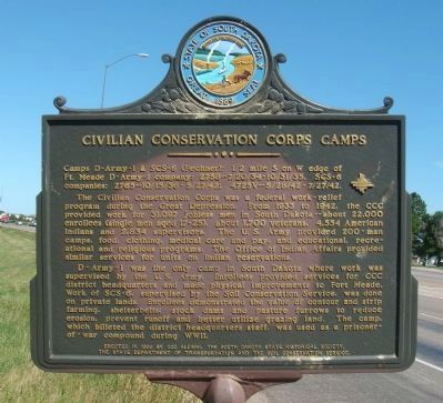
Civilian Conservation Corps Camps
The Civilian Conservation Corps was a federal work-relief program during the Great Depression. From 1933 to 1942, the CCC provided work for 31,097 jobless men in South Dakota--about 22,000 enrollees (single men aged 17-25), about 1,700 veterans, 4,554 American Indians and 2,834 supervisors. The U.S. Army provided 200-man camps, food, clothing, medical care and pay, and educational, recreational and religious programs. The Office of Indian Affairs provided similar services for units on Indian reservations.
D-Army-1 was the only camp in South Dakota where work was supervised by the U.S. Army. Enrollees provided services for CCC district headquarters and made physical improvements to Fort Meade. Work of SCS-6, supervised by the Soil Conservation Service, was done on private lands. Enrollees demonstrated the value of contour and strip erosion, prevent runoff and better utilize grazing land. The camp, which billeted the district headquarters staff, was used as a prisoner-of-war compound during WWII.
Erected 1990 by CCC Alumni, the South Dakota State Historical Society, the State Department of Transportation, and the Soil Conservation Service. (Marker Number 512.)
Topics and series. This historical marker is listed in these topic lists: Charity & Public Work • Native Americans. In addition, it is included in the Civilian Conservation Corps (CCC), and the South Dakota State Historical Society Markers series lists. A significant historical year for this entry is 1933.
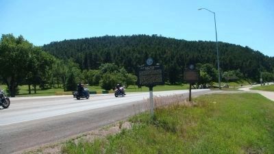
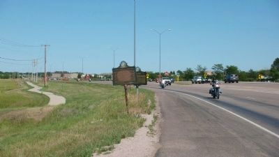
Location. 44° 24.714′ N, 103° 28.964′ W. Marker is in Sturgis, South Dakota, in Meade County. Marker is at the intersection of South Dakota Route 34 and Custer Avenue, on the left when traveling east on State Route 34. Touch for map. Marker is in this post office area: Sturgis SD 57785, United States of America. Touch for directions.
Other nearby markers. At least 8 other markers are within 2 miles of this marker, measured as the crow flies. Bear Butte (Mato Paha) Indian Camp (here, next to this marker); Charles D. Roberts (approx. 0.6 miles away); Fort Meade Museum (approx. 0.6 miles away); It Started Here (approx. 0.6 miles away); Fourth Cavalry Group Veterans Memorial (approx. 0.6 miles away); 8 Inch Towed Howitzer (M115) (approx. 0.6 miles away); Charles Nolin (approx. 0.6 miles away); a different marker also named Charles Nolin (approx. 1˝ miles away). Touch for a list and map of all markers in Sturgis.
Related markers. Click here for a list of markers that are related to this marker. (other South Dakota Civilian Conservation Corps Camp markers)
Additional keywords.
Great Depression
Credits. This page was last revised on October 18, 2021. It was originally submitted on August 8, 2010, by William J. Toman of Green Lake, Wisconsin. This page has been viewed 1,256 times since then and 14 times this year. Last updated on October 17, 2021. Photos: 1, 2, 3. submitted on August 8, 2010, by William J. Toman of Green Lake, Wisconsin. • Mark Hilton was the editor who published this page.


