Near Belington in Barbour County, West Virginia — The American South (Appalachia)
Laurel Hill
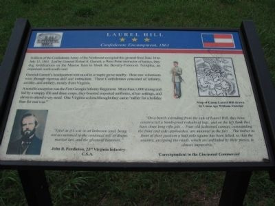
Confederate Encampment, 1861
General Garnett's headquarters tent stood in a maple grove nearby. Here raw volunteers went through rigorous drill and instruction. These Confederates consisted of infantry, cavalry, and artillery, mostly from Virginia.
A notable exception was the First Georgia Infantry Regiment. More than 1,000 strong and led by a snappy fife and drum corps, they boasted imported uniforms, silver settings, and slaves to attend every need. One Virginia colonel thought they came "rather for a holiday than for real war."
"I feel as if I was in an unknown land, being not accustomed to the continual roll of drums, martial law, and the gleam of bayonets."
John B. Pendleton, 23rd Virginia Infantry C.S.A.
"On a bench extending from the side of Laurel Hill, they have constructed a bomb-proof redoubt of logs and on the left flank they have three long rifle pits... Four old fashioned cannon, commanding the front and side approaches, are mounted in the fort... The timber in front of their position a half mile square has been felled, so that the country, excepting the roads, which are enfiladed by their pieces, is almost impassable."
Correspondent to the Cincinnati Commercial
Topics. This historical marker is listed in this topic list: War, US Civil. A significant historical month for this entry is June 1852.
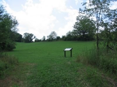
Location. 39° 0.55′ N, 79° 54.7′ W. Marker is near Belington, West Virginia, in Barbour County. Marker can be reached from Laurel Mountain Road (County Route 15), on the right when traveling east. Located in Laurel Hill Camp beside the Mill Creek Reservoir. Touch for map. Marker is in this post office area: Belington WV 26250, United States of America. Touch for directions.
Other nearby markers. At least 8 other markers are within walking distance of this marker. Civil War (about 400 feet away, measured in a direct line); Battle of Laurel Hill (about 700 feet away); Camp Laurel Hill (approx. 0.2 miles away); Welcome to Camp Laurel Hill (approx. 0.2 miles away); Laurel Hill Battlefield Veterans Memorial (approx. 0.2 miles away); In Honor of these whose Sacrifices Created this Hallowed Ground (approx. 0.2 miles away); Cannons (approx. 0.2 miles away); a different marker also named Laurel Hill (approx. 0.2 miles away). Touch for a list and map of all markers in Belington.
More about this marker. The marker displays a portrait of John Pendleton, an illustration of a Confederate soldier, and a map of the camp.
Also see . . .
Battle of Laurel Hill. Web site with details of the battle. (Submitted on August 15, 2010, by Craig Swain of Leesburg, Virginia.)
Credits. This page was last revised on June 16, 2016. It was originally submitted on August 15, 2010, by Craig Swain of Leesburg, Virginia. This page has been viewed 1,132 times since then and 28 times this year. Photos: 1, 2, 3, 4. submitted on August 15, 2010, by Craig Swain of Leesburg, Virginia.


