Stratford in Westmoreland County, Virginia — The American South (Mid-Atlantic)
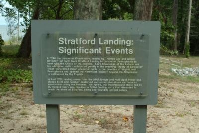
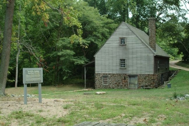
Stratford Landing: Significant Events
In April 1781, landing crews from the HMS Savage and HMS Best Bower and sloops Swift and Rambler destroyed and looted plantations and tobacco warehouses along the Potomac. On April 9, the Westmoreland Militia, led by Lt. Richard Henry Lee, repulsed a British landing party that attempted to reach the shore at Stratford, killing and wounding several sailors.
Topics. This historical marker is listed in these topic lists: Colonial Era • Waterways & Vessels. A significant historical month for this entry is April 1781.
Location. 38° 9.774′ N, 76° 49.913′ W. Marker is in Stratford, Virginia, in Westmoreland County. Marker can be reached from Great House Road. The marker is on the grounds of Stratford Hall Plantation, the birthplace of Robert E. Lee. The historic site is on Stratford Hall Road (VA Highway 214), on the left when traveling east. The site is open to the public, for a fee. Touch for map. Marker is in this post office area: Stratford VA 22558, United States of America. Touch for directions.
Other nearby markers. At least 8 other markers are within walking distance of this marker. The Landing: Gateway to the World (here, next to this marker); The Stratford Mill (within shouting distance of this marker); Controlling the Water Supply to the Mill (within shouting distance of this marker); The Stratford Cliffs (approx. ¼ mile away); Clifts Plantation Site (approx. 0.4 miles away); Clifts Plantation Burial Ground (approx. 0.4 miles away); American Indians at Stratford (approx. 0.8 miles away); Slave Cemetery (approx. 0.8 miles away). Touch for a list and map of all markers in Stratford.
Also see . . . Stratford Hall Historic Site. (Submitted on August 15, 2010, by Paul Jordan of Burlington, N. C., U. S. A..)
Additional keywords. Robert E. Lee, Stratford Hall Plantation
Credits. This page was last revised on June 16, 2016. It was originally submitted on August 15, 2010, by Paul Jordan of Burlington, N. C., U. S. A.. This page has been viewed 646 times since then and 11 times this year. Photos: 1, 2, 3. submitted on August 15, 2010, by Paul Jordan of Burlington, N. C., U. S. A.. • Bill Pfingsten was the editor who published this page.


