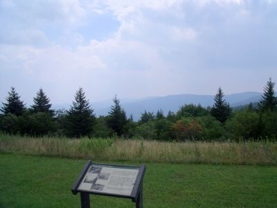
Near Marlinton in Pocahontas County, West Virginia — The American South (Appalachia)
Black Mountain Fire
In the early 1900’s, loggers from eight camps in this valley hauled valuable spruce on narrow gauge railroads. They left a cutover landscape of dry spruce limbs and needles. This tinderbox burst into flame in 1930, probably set by train cinders. Can you picture this beautiful valley as a black and barren wasteland?
Walk the boardwalk to your left, to see signs of logging, fire, and forest renewal.
Site Elevation 4,520 Ft.
Erected by US Forest Service.
Topics. This historical marker is listed in these topic lists: Environment • Horticulture & Forestry. A significant historical year for this entry is 1930.
Location. 38° 16.123′ N, 80° 14.356′ W. Marker is near Marlinton, West Virginia, in Pocahontas County. Marker is on Highland Scenic Highway (West Virginia Route 150) 8.1 miles Bruffey Reserve (West Virginia Route 39), on the right when traveling north. Touch for map. Marker is in this post office area: Marlinton WV 24954, United States of America. Touch for directions.
Other nearby markers. At least 8 other markers are within 9 miles of this marker, measured as the crow flies. More Than Meets The Eye (approx. 1˝ miles away); A History (approx. 5.9 miles away); Cranberry Glades (approx. 6.3 miles away); Big Lime (approx. 7.7 miles away); Edray (approx. 8 miles away); Marlinton (approx. 8.2 miles away); Frank and Anna Hunter House (approx. 8.2 miles away); Welcome to Pocahontas County (approx. 8.2 miles away). Touch for a list and map of all markers in Marlinton.
Also see . . . Highland Scenic Highway. Forest Service, U.S. Department of Agriculture (Submitted on August 15, 2010.)
Credits. This page was last revised on November 14, 2021. It was originally submitted on August 15, 2010, by Bernard Fisher of Richmond, Virginia. This page has been viewed 775 times since then and 34 times this year. Photos: 1, 2. submitted on August 15, 2010, by Bernard Fisher of Richmond, Virginia.

