Stratford in Westmoreland County, Virginia — The American South (Mid-Atlantic)
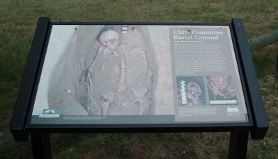
Clifts Plantation Burial Ground
Who Was Buried Here?
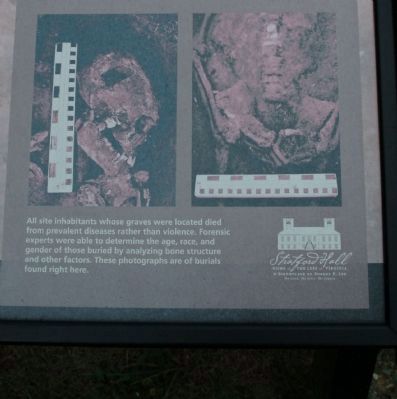
Archaeologists found 17 burials in the cemetery - seven white and ten black. In the early 18th century, wealthy planters throughout the Chesapeake turned increasingly from white to enslaved black labor. To a large extent, the switch from indentured whites to black slaves working on Virginia plantations resulted from a decline in the number of Europeans willing to leave home and a rise in the trade of enslaved Africans.
The burials at the Clifts site followed the typical European practice of placing the dead in a shroud and coffin.
Topics. This historical marker is listed in these topic lists: Cemeteries & Burial Sites • Colonial Era.
Location. 38° 9.561′ N, 76° 50.214′ W. Marker is in Stratford, Virginia, in Westmoreland County. Marker can be reached from Great House Road. The marker is on the grounds of Stratford Hall Plantation, the birthplace of Robert E. Lee. The historic site is on Stratford Hall Road (VA Highway 214), on the left when traveling east. The site is open to the public, for a fee. Touch for map. Marker is in this post office area: Stratford VA 22558, United States of America. Touch for directions.
Other nearby markers. At least 8 other markers are within walking distance of this marker. Clifts Plantation Site (here, next to this marker); The Stratford Cliffs (approx. ¼ mile away); The Stratford Mill (approx. 0.4 miles away); Controlling the Water Supply to the Mill (approx. 0.4 miles away); Stratford Landing: Significant Events (approx. 0.4 miles away); The Landing: Gateway to the World (approx. 0.4 miles away); American Indians at Stratford (approx. half a mile away); Slave Cemetery (approx. 0.6 miles away). Touch for a list and map of all markers in Stratford.
Also see . . . Stratford Hall Historic Site. (Submitted on August 18, 2010, by Paul Jordan of Burlington, N. C., U. S. A..)

Photographed By Paul Jordan, August 2, 2010
2. Clifts Plantation Burial Ground Marker
Credits. This page was last revised on June 16, 2016. It was originally submitted on August 18, 2010, by Paul Jordan of Burlington, N. C., U. S. A.. This page has been viewed 837 times since then and 10 times this year. Photos: 1, 2, 3. submitted on August 18, 2010, by Paul Jordan of Burlington, N. C., U. S. A.. • Bill Pfingsten was the editor who published this page.

