Locust Point Industrial Area in Baltimore, Maryland — The American Northeast (Mid-Atlantic)
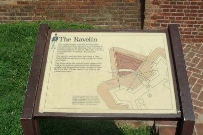
The Ravelin
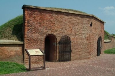
This wedge-shaped outwork protected the fort's sally port from enemy fire, and helped to control access to the star fort. The U.S. Army built the original ravelin in 1813. The structure was modified to its presents dimensions in 1837.
The ravelin and dry moat provided a first line of defense against a land attack, but none ever came.
Two doors along the ravelin's rear scarp walls lead to an underground magazine where gunpowder and ammunition were stored just after the Civil War. Please watch your step on the curved stairways.
In 1814 the ravelin stood like a brick island in a dry moat. Removable bridges connected the star fort with the outside world. The ravelin's triangular design offered enemy soldiers no place to take cover from the star fort's guns.
Erected by National Park Service, U.S. Department of the Interior.
Topics. This historical marker is listed in these topic lists: Forts and Castles • War of 1812. A significant historical year for this entry is 1813.
Location. Marker has been reported permanently removed. It was located near 39° 15.814′ N, 76° 34.762′ W. Marker was in Baltimore, Maryland. It was in the Locust Point Industrial Area. Marker is on grounds of Fort McHenry National Monument. Touch for map. Marker was in this post office area: Baltimore MD 21230, United States of America.
We have been informed that this sign or monument is no longer there and will not be replaced. This page is an archival view of what was.
Other nearby markers. At least 8 other markers are within walking distance of this location. Fort McHenry (a few steps from this marker); A Star Spangled Centennial (a few steps from this marker); Bombproofs (a few steps from this marker); Entering Fort McHenry … A Deadly Crossfire (within shouting distance of this marker); In Full Glory Reflected (within shouting distance of this marker); Ravelin Magazine (within shouting distance of this marker); Civil War Guardhouse (within shouting distance of this marker); 1814 Enlisted Men's Barracks, No 2 (within shouting distance of this marker). Touch for a list and map of all markers in Baltimore.
Also see . . .
1. Fort McHenry National Monument and Historic Shrine. National Park Service (Submitted on August 19, 2010, by Paul Jordan of Burlington, N. C., U. S. A..)
2. Battle of Baltimore. HistoryCentral.com (Submitted on August 19, 2010, by Paul Jordan of Burlington, N. C., U. S. A..)
Credits. This page was last revised on April 17, 2022. It was originally submitted on August 19, 2010, by Paul Jordan of Burlington, N. C., U. S. A.. This page has been viewed 894 times since then and 13 times this year. Last updated on March 27, 2022, by Connor Olson of Kewaskum, Wisconsin. Photos: 1, 2. submitted on August 19, 2010, by Paul Jordan of Burlington, N. C., U. S. A.. 3. submitted on August 22, 2010, by Craig Swain of Leesburg, Virginia. • J. Makali Bruton was the editor who published this page.


