Strasburg in Shenandoah County, Virginia — The American South (Mid-Atlantic)
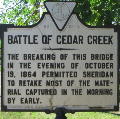
Battle of Cedar Creek
The breaking of this bridge in the evening of October 19, 1864 permitted Sheridan to retake most of the material captured in the morning by Early.
Erected 1927 by Conservation & Development Commission. (Marker Number A-21.)
Topics and series. This historical marker is listed in this topic list: War, US Civil. In addition, it is included in the Virginia Department of Historic Resources (DHR) series list. A significant historical date for this entry is October 19, 1885.
Location. 38° 59.347′ N, 78° 22.441′ W. Marker is in Strasburg, Virginia, in Shenandoah County. Marker is on Valley Pike (U.S. 11), on the right when traveling north. Located in the parking lot for the Old Mill Restaurant on the south west side of Strasburg. Touch for map. Marker is in this post office area: Strasburg VA 22657, United States of America. Touch for directions.
Other nearby markers. At least 8 other markers are within walking distance of this marker. Historic Strasburg (approx. half a mile away); Sonner House (approx. half a mile away); Sunset Hill School (approx. half a mile away); Open House (approx. 0.6 miles away); a different marker also named Historic Strasburg (approx. 0.6 miles away); a different marker also named Historic Strasburg (approx. 0.6 miles away); Saint Paul’s Lutheran Church (approx. 0.6 miles away); Signal Knob (approx. 0.6 miles away). Touch for a list and map of all markers in Strasburg.
Regarding Battle of Cedar Creek. The Cedar Creek battlefield is interpreted by several markers. See the Battle of Cedar Creek Virtual Tour by Markers link.
Also see . . .
1. Battle of Cedar Creek Staff Ride. The bridge at Spangler's Mill is Stop 1A on the Center of Military History's staff ride of the Cedar Creek battlefield. (Submitted on November 11, 2007, by Craig Swain of Leesburg, Virginia.)
2. Battle of Cedar Creek Summary. The action here is detailed as phase 10 of the National Parks Service summary of the battle. (Submitted on November 11, 2007, by Craig Swain of Leesburg, Virginia.)
3. The Old Mill Restaurant. Restaurant website homepage (Submitted on November 11, 2007, by Craig Swain of Leesburg, Virginia.)
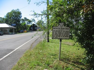
Photographed By Craig Swain, September 29, 2007
2. Looking Back at the Old Mill
Battle of Cedar Creek Virtual Tour by eight related HMDb markers.
Click for more information.
Click for more information.
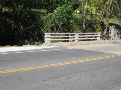
Photographed By Craig Swain, September 29, 2007
3. The Modern Bridge
To the right, downstream from the bridge and to the east, is the North Fork of the Shenandoah River. With hills and high ground to the west, including Fisher's Hill, this was a natural choke point constraining movement to and from the battlefield area.
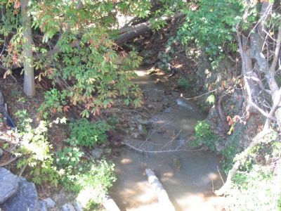
Photographed By Craig Swain, September 29, 2007
4. The Creek
Doesn't look like much, but for a traveler bound by the wagons of the day, this was a barrier. In the morning of October 19, 1864, two Confederate divisions passed this point moving north to engage Federal forces on the north side of Cedar Creek. Later in the day, Confederate wagons became tangled in the wooden bridge over the creek, blocking the avenue of retreat.
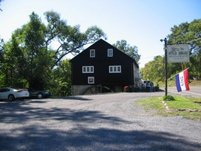
Photographed By Craig Swain, September 29, 2007
5. Spangler's Mill
While other mills around the Shenandoah were destroyed in the fall of 1864 by Sheridan's forces to deprive the Confederates use of the milled grain, this mill survived. At the time Federal forces were using the mill to grind grains for their needs. During the battle, the ground around here was a casualty collection point for Confederate medical services.
Credits. This page was last revised on July 6, 2023. It was originally submitted on November 11, 2007, by Craig Swain of Leesburg, Virginia. This page has been viewed 2,591 times since then and 18 times this year. Photos: 1, 2, 3, 4, 5. submitted on November 11, 2007, by Craig Swain of Leesburg, Virginia.
