Lead in Lawrence County, South Dakota — The American Midwest (Upper Plains)
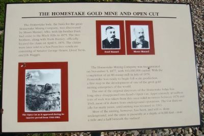
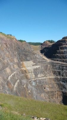
The Homestake Gold Mine and Open Cut
The Homestake Mining Company was incorporated on November 5, 1877, with $10,000,000 capital. With the completion of an 80-stamp mill in July of 1878, Homestake was ready to begin full-scale production, a first step in the development of one of the great gold mining enterprises of the world.
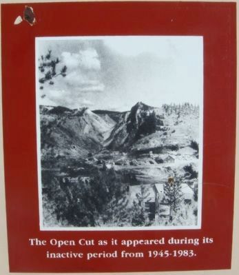
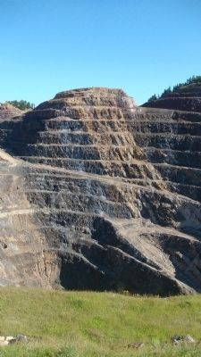
The site of the original discovery of the Homestake ledge has long since disappeared into Lead's Open Cut. Approximately 40 million tons of rock was taken from this once-solid mountain between 1876 and 1945, most of it drawn from underground operations. The Cut then sat idle for many years, until mining was resumed in 1983.
Most of the mining, however, has been, and still is, done underground, and the mine is presently at a depth of 8,000 feet - over a mile and a half beneath the surface!
Topics. This historical marker is listed in this topic list: Industry & Commerce. A significant historical month for this entry is April 1997.
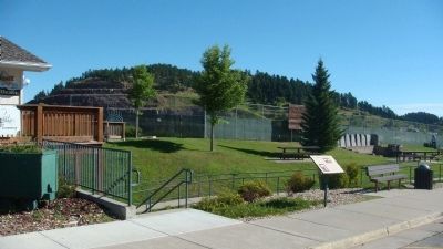
Location. 44° 21.12′ N, 103° 45.826′ W. Marker is in Lead, South Dakota, in Lawrence County. Marker is at the intersection of West Main Street (U.S. 85) and Bleeker Street, on the left when traveling east on West Main Street. The marker is in front of the Homestake Visitor Center. Touch for map. Marker is at or near this postal address: 160 West Main Street, Lead SD 57754, United States of America. Touch for directions.
Other nearby markers. At least 8 other markers are within walking distance of this marker. Homestake Open Cut Mine (within shouting distance of this marker); Sweatman Art Memorial / Finnish Lutheran Church (within shouting distance of this marker); Ray Davis and the Homestake Experiment (within shouting distance of this marker); The Open Cut (within shouting distance of this marker); Homestake Gas-Powered Locomotive (about 300 feet away, measured in a direct line); Pneumatic Rock Drill (about 400 feet away); The First National (Norwest) Bank (about 500 feet away); Homestake One Ton, End Dump Ore Car (about 500 feet away). Touch for a list and map of all markers in Lead.
Photographed By William J. Toman, August 10, 2010
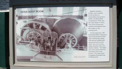
6. Nearby Related Marker: Yates Hoist Room
Gigantic elevators (hoists) were installed on the surface at Homestake's two primary shafts - the Ross Shaft (completed in 1934) and the Yates Shaft (in 1941). The hoists transported workers and material from the surface to the underground.
At full production, 700 Homestake Mine employees were lowered and hoisted each working day, along with mining supplies and equipment such as drill steel, mine cars, trucks, utility vehicles, drills, and electric motors. The hoists were also used to haul ore and waste rock to the surface. The Yates Hoist is capable of transporting 12,000 pounds.
At full production, 700 Homestake Mine employees were lowered and hoisted each working day, along with mining supplies and equipment such as drill steel, mine cars, trucks, utility vehicles, drills, and electric motors. The hoists were also used to haul ore and waste rock to the surface. The Yates Hoist is capable of transporting 12,000 pounds.
Photographed By William J. Toman, August 10, 2010
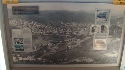
7. Nearby Display Regarding Lead
Text: The view shows Lead City as it looked in 1888, only 12 years after the discovery of the Homestake lead. One of the Homestake mills can be seen in the foreground. Note the absence of trees on the surrounding hills.
Photographed By William J. Toman, August 10, 2010
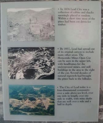
8. Closeup of Sidebar on Lead Display
Text for first photo:
• In 1876 Lead City was a collection of cabins and shacks seemingly placed at random. Within a short time most of the pines had been cut down for timber.
Text for second photo:
• By 1937, Lead had spread out of its original canyon to include many other areas. The Homestake Mines Open Cut can be seen in the upper left, with headframes for the underground mines, and mill buildings in the area to the right of the cut. Several decades of natural regrowth had brought the pines back to the hillsides.
Text for third photo:
• The City of Lead today is a four-dimensional community over a mile above sea level, over one mile in length, over one mile in width, with mine shafts that are well over a mile and a half in depth.
Photographed By William J. Toman, August 10, 2010
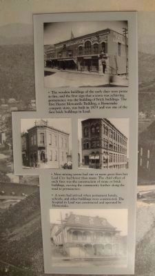
9. Closeup of Sidebar on Lead Display
Text:
• The wooden buildings of the early days were prone to fire, and the first sign that a town was achieving permanence was the building of brick buildings. The first Hearst Mercantile Building, a Homestake company store, was built in 1879 and was one of the first brick buildings in Lead.
• Most mining towns had one or more great fires but Lead City had fewer than many. The chief effect of such fires was the construction of stone or brick buildings, moving the community further along the road to permanence.
• A town had arrived when permanent hotels, schools, and other buildings were constructed. The hospital in Lead was constructed and operated by Homestake.
Credits. This page was last revised on June 16, 2016. It was originally submitted on August 22, 2010, by William J. Toman of Green Lake, Wisconsin. This page has been viewed 2,357 times since then and 51 times this year. Photos: 1, 2, 3, 4, 5. submitted on August 22, 2010, by William J. Toman of Green Lake, Wisconsin. 6, 7, 8, 9. submitted on August 23, 2010, by William J. Toman of Green Lake, Wisconsin. • Bill Pfingsten was the editor who published this page.
