Independence in Jackson County, Missouri — The American Midwest (Upper Plains)
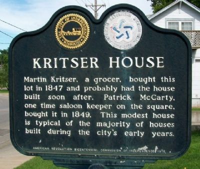
Kritser House
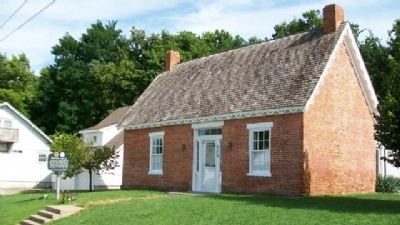
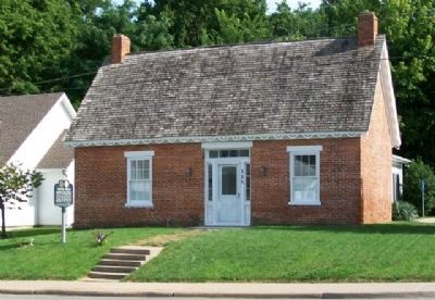
Martin Kritser, a grocer, bought this lot in 1847 and probably had the house built soon after. Patrick McCarty, one time saloon keeper on this square, bought it in 1849. This modest house is typical of the majority of houses built during the city's early years.
Erected 1976 by American Revolution Bicentennial Commission of Independence.
Topics and series. This historical marker is listed in these topic lists: Architecture • Industry & Commerce • Settlements & Settlers. In addition, it is included in the The Spirit of ’76, America’s Bicentennial Celebration series list. A significant historical year for this entry is 1847.
Location. 39° 5.389′ N, 94° 24.892′ W. Marker is in Independence, Missouri, in Jackson County. Marker is at the intersection of Walnut Street and Lynn Street, on the right when traveling east on Walnut Street. Touch for map. Marker is at or near this postal address: 115 East Walnut Street, Independence MO 64050, United States of America. Touch for directions.
Other nearby markers. At least 8 other markers are within walking distance of this marker. 1827 Log Courthouse (about 600 feet away, measured in a direct line); Harpie Club (approx. 0.2 miles away); Our Jackson County Pioneers (approx. 0.2 miles away); Harry S. Truman (approx. 0.2 miles away); Bryant House (approx. 0.2 miles away); A Century of Progress (approx. 0.2 miles away); First Battle of Independence (approx. 0.2 miles away); Santa Fe Trail (approx. 0.2 miles away). Touch for a list and map of all markers in Independence.
More about this marker. The National Park Service Santa Fe National Historic Trail Map states: "The Martin O. Kritser house at 115 W. [sic] Walnut was built in 1847. Kritser made at least one trip to Santa Fe in 1844. It is typical of the average middle class home in Independence, during its heyday as the eastern terminus of the Santa Fe Trail."
Also see . . . Kritser House. National Register of Historic Places Nomination Form (Submitted on May 2, 2022, by Larry Gertner of New York, New York.)
Credits. This page was last revised on May 2, 2022. It was originally submitted on August 24, 2010, by William Fischer, Jr. of Scranton, Pennsylvania. This page has been viewed 878 times since then and 9 times this year. Photos: 1, 2, 3. submitted on August 24, 2010, by William Fischer, Jr. of Scranton, Pennsylvania.


