Marker Logo HMdb.org THE HISTORICAL
MARKER DATABASE
“Bite-Size Bits of Local, National, and Global History”
Lafayette in Tippecanoe County, Indiana — The American Midwest (Great Lakes)
 

John T. Myers

Main Street Bridge


John T. Myers Marker image. Click for full size.
Photographed By Courtesy:: Trevor Searcy, August 22, 2010
1. John T. Myers Marker
(Click any of these photos to see the details.)
Inscription.
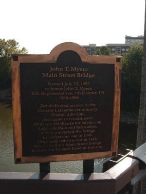
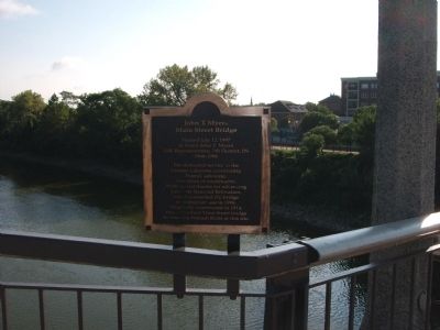
Named July 12, 1997
to honor John T. Myers
U.S. Representative, 7th District, IN
1966-1996.

For dedicated service to the Greater Lafayette community. Friend, advocate, champion of constituents. With special thanks for advancing Lafayette Railroad Relocation, which converted the bridge to pedestrian use in 1996. Originally constructed in 1914, this is the third Main Street bridge to cross the Wabash River at this site.
 
Erected 1997.
 
Topics. This historical marker is listed in these topic lists: Bridges & ViaductsWaterways & Vessels. A significant historical date for this entry is July 12, 1778.
 
Location. 40° 25.171′ N, 86° 53.846′ W. Marker is in Lafayette, Indiana, in Tippecanoe County. Marker is at the intersection of John T. Myers Pedestrian Bridge and North 2nd Street, on the left when traveling east on John T. Myers Pedestrian Bridge. Located on the North side - and in the middle (over the Wabash River) of the "John T. Myers Pedestrian Bridge" - - leading from West Lafayette off of "Tapawingo Drive" to the 'Big Four' Train Station located in Lafayette at North 2nd -and- Main Street. Touch for map. Marker is in this post office area: Lafayette IN 47901, United States of America. Touch for directions.
 
Other nearby markers. At least 8 other markers are within walking distance of this marker. Iraq War Memorial (about 400 feet away, measured in a direct line);
Paid Advertisement
Click on the ad for more information.
Please report objectionable advertising to the Editor.
Click or scan to see
this page online
Big Four Depot (about 400 feet away); The Purple Heart Memorial (about 500 feet away); Main Street Bridge (about 700 feet away); John Purdue Block (approx. 0.2 miles away); The Tippecanoe County Courthouse (approx. 0.2 miles away); To Commemorate The Wabash and Erie Canal (approx. 0.2 miles away); Earl & Hatcher Block (approx. 0.2 miles away). Touch for a list and map of all markers in Lafayette.
 
Related marker. Click here for another marker that is related to this marker. History - Main Street Bridge.
 
Wide View - - John T. Myers Marker image. Click for full size.
Photographed By Courtesy:: Trevor Searcy, August 22, 2010
2. Wide View - - John T. Myers Marker
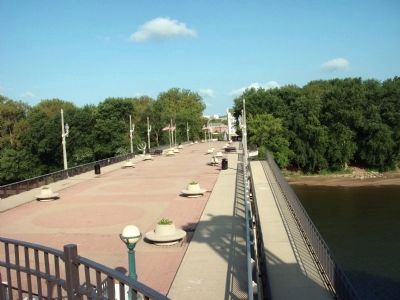
Looking toward West Lafayette - - John T. Myers Pedestrian Bridge image. Click for full size.
Photographed By Courtesy:: Trevor Searcy, August 22, 2010
3. Looking toward West Lafayette - - John T. Myers Pedestrian Bridge
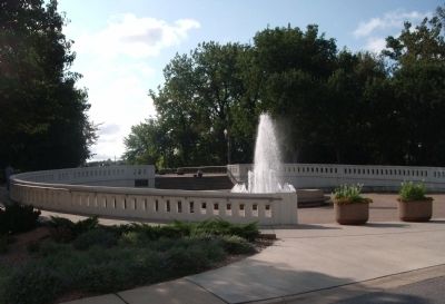
West Lafayette can be seen at the far end of the bridge. (Click on the photo.) The marker (can not see) is on the right behind a lamp post on the bridge - at the center of the Wabash River. Also note the "Sonya L. Margerum Water Fountain" at the end of the bridge in West Lafayette.
Wide View - - "Sonya L. Margerum Water Fountain" in West Lafayette, Indiana image. Click for full size.
Photographed By Courtesy:: Trevor Searcy, August 22, 2010
4. Wide View - - "Sonya L. Margerum Water Fountain" in West Lafayette, Indiana
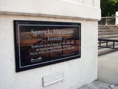
Dedication Plaque - - " Sonya L. Margerum - Fountain " image. Click for full size.
Photographed By Courtesy:: Trevor Searcy, August 22, 2010
5. Dedication Plaque - - " Sonya L. Margerum - Fountain "
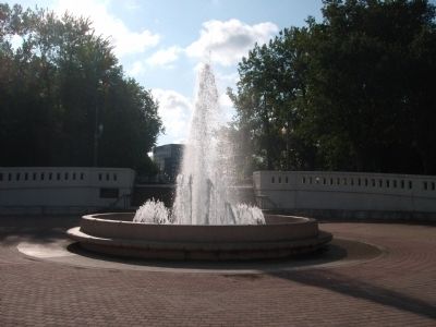
Sonya L. Margerum Water Fountain - - West Lafayette image. Click for full size.
Photographed By Courtesy:: Trevor Searcy, August 22, 2010
6. Sonya L. Margerum Water Fountain - - West Lafayette
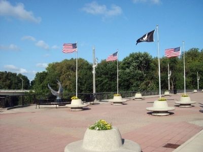
Bridge Center - South Side - - " Millennium Sundial " image. Click for full size.
Photographed By Courtesy:: Trevor Searcy, August 22, 2010
7. Bridge Center - South Side - - " Millennium Sundial "
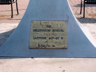
Base of " Millennium Sundial " image. Click for full size.
Photographed By Courtesy:: Carly C. Kindig, August 22, 2010
8. Base of " Millennium Sundial "
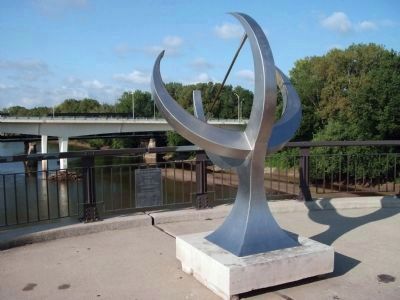
South - Full View - - " Millennium Sundial " image. Click for full size.
Photographed By Courtesy:: Trevor Searcy, August 22, 2010
9. South - Full View - - " Millennium Sundial "
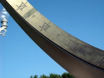
Time - - Noted by " Millennium Sundial " image. Click for full size.
Photographed By Courtesy:: Carly C. Kindig, August 22, 2010
10. Time - - Noted by " Millennium Sundial "
Dedication and Instruction Plaque of " Millennium Sundial " image. Click for full size.
Photographed By Courtesy:: Trevor Searcy, August 22, 2010
11. Dedication and Instruction Plaque of " Millennium Sundial "
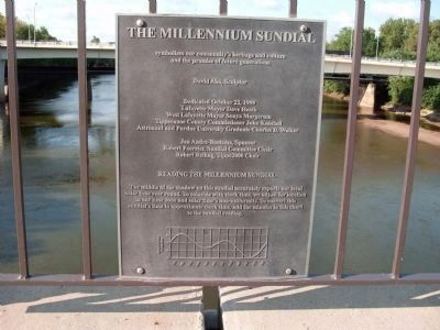
Reading the Millennium Sundial
The middle of the shadow on this sundial accurately reports our local solar time year round. To coincide with clock time, we adjust for location in our time zone and solar time's non-uniformity. To convert this sundial's time to approximate clock time, add the minutes in this chart to the sundial reading.
Looking West - - Gantry Behind - Big Four Depot - - In Lafayette, Indiana image. Click for full size.
Photographed By Courtesy:: Trevor Searcy, August 22, 2010
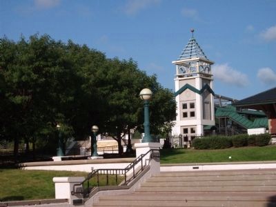
12. Looking West - - Gantry Behind - Big Four Depot - - In Lafayette, Indiana
Note in back-ground the 'John T. Myers Pedestrian Bridge'.
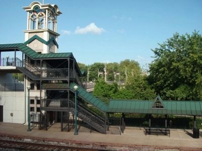
Left of Big Four Depot - - Lafayette, Indiana image. Click for full size.
Photographed By Courtesy:: Trevor Searcy, August 22, 2010
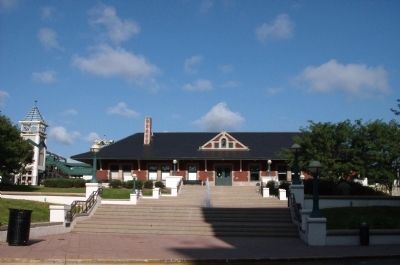
13. Left of Big Four Depot - - Lafayette, Indiana
Full View - - Big Four Train Station - Lafayette, Indiana image. Click for full size.
Photographed By Courtesy:: Trevor Searcy, August 22, 2010
14. Full View - - Big Four Train Station - Lafayette, Indiana
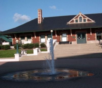
Water Fountain - Big Four Train Depot in Lafayette, Indiana image. Click for full size.
Photographed By Courtesy:: Carly C. Kindig, August 22, 2010
15. Water Fountain - Big Four Train Depot in Lafayette, Indiana
 
 
Credits. This page was last revised on June 16, 2016. It was originally submitted on August 25, 2010, by Al Wolf of Veedersburg, Indiana. This page has been viewed 2,062 times since then and 64 times this year. Photos:   1, 2, 3, 4, 5, 6, 7, 8, 9, 10, 11, 12, 13, 14, 15. submitted on August 25, 2010, by Al Wolf of Veedersburg, Indiana. • Syd Whittle was the editor who published this page.
Share this page.  
Share on Tumblr
m=34869

CeraNet Cloud Computing sponsors the Historical Marker Database.
This website earns income from purchases you make after using our links to Amazon.com. We appreciate your support.
Paid Advertisement
Apr. 19, 2024