Herriman in Salt Lake County, Utah — The American Mountains (Southwest)
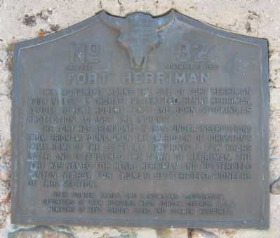
Fort Herriman
The Fort was abandoned in 1858, under instructions from Brigham Young upon the approach of Johnston's Army. Some of the settlers returned a few years later and established the Town of Herriman. The Fort was named for Henry Herriman and Butterfield Canyon nearby for Thomas Butterfield, pioneers of this section.
Erected 1933 by Utah Pioneer Trails and Landmarks Association, Daughters of Utah Pioneers, West Jordan District B.S.A, Members of West Jordan Stake and former residents. (Marker Number 32.)
Topics and series. This historical marker is listed in these topic lists: Forts and Castles • Settlements & Settlers. In addition, it is included in the Daughters of Utah Pioneers, and the Utah Pioneer Trails and Landmarks Association series lists. A significant historical year for this entry is 1855.
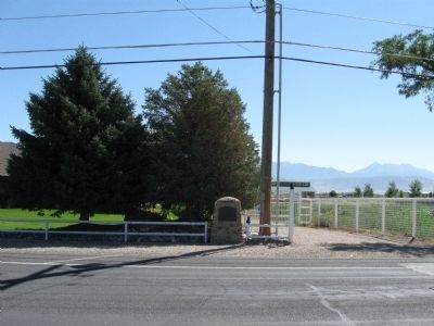
Location. 40° 31.245′ N, 112° 1.973′ W. Marker is in Herriman, Utah, in Salt Lake County. Marker is on North Pioneer Street (6000 W), 0.1 miles south of Un Road, on the right when traveling north. Touch for map. Marker is at or near this postal address: 12677 North Pioneer Street, Herriman UT 84096, United States of America. Touch for directions.
Other nearby markers. At least 8 other markers are within 5 miles of this marker, measured as the crow flies. Pioneer Rock Church (approx. 0.4 miles away); Thomas Butterfield (approx. half a mile away); Bingham Tunnel (approx. 3.3 miles away); Bingham City Cemetery Veterans Memorial (approx. 4 miles away); Wardle Fields Regional Park (approx. 4.2 miles away); Copperton Community Methodist Church (approx. 4.4 miles away); Honoring with Glory (approx. 4˝ miles away); Early Settlers of Bluffdale (approx. 4.8 miles away). Touch for a list and map of all markers in Herriman.
Credits. This page was last revised on June 16, 2016. It was originally submitted on August 17, 2010, by Jack Duffy of West Jordan, Utah. This page has been viewed 2,306 times since then and 63 times this year. Last updated on August 29, 2010, by Bryan R. Bauer of Kearns, Ut 84118. Photos: 1, 2, 3. submitted on August 17, 2010, by Jack Duffy of West Jordan, Utah. • Kevin W. was the editor who published this page.


