Fort Belvoir in Fairfax County, Virginia — The American South (Mid-Atlantic)
The Birth of a River
Inscription.
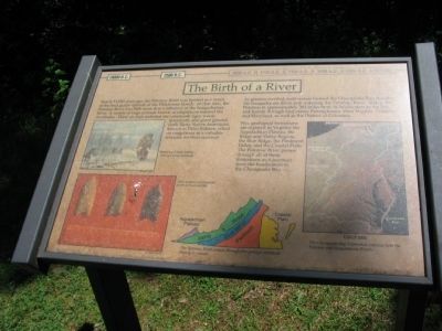
Nearly 12,000 years ago, the Potomac River was formed as a result of the final glacial episode of the Pleistocene Epoch. At that time, the Potomac River was little more than a tributary of the Susquehanna River. A variety of large animals known as megafauna roamed the riverbanks. These animals included the sabertooth tiger, wooly mammoth, and giant ground sloth. Early Native Americans known as Paleo Indians, relied on megafauna as a valuable resource for their survival.
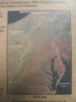
As glaciers receded, melt waters formed the Chesapeake Bay, flooding the Susquehanna River and widening the Potomac River. Today, the Potomac is approximately 383 miles from its headwaters to the Bay and travels through four states: Pennsylvania, West Virginia, Virginia, and Maryland, as well as the District of Columbia.
Five geological formations are exposed in Virginia: the Appalachian Plateau, the Ridge and Valley Region, the Blue Ridge, and the Piedmont Valley, and the Coastal Plain. The Potomac River passes through all of these formations as it journeys from the headwaters to the Chesapeake Bay.
Topics. This historical marker is listed in this topic list: Natural Features.
Location. 38° 40.708′ N, 77° 7.767′ W. Marker is in Fort Belvoir, Virginia, in Fairfax County . Marker can be reached from Forney Loop, on the right when traveling south. Located along the Belvoir and Potomac View Trail, reached from a parking area off Forney Lane, on Fort Belvoir. Touch for map. Marker is in this post office area: Fort Belvoir VA 22060, United States of America. Touch for directions.
Other nearby markers. At least 8 other markers are within walking distance of this marker. The Army Comes to Belvoir (within shouting distance of this marker); Belvoir Grounds and Potomac View Trail (within shouting distance of this marker); Ferdinando, and the End of the Fairfax Ownership (about 300 feet away, measured in a direct line); The Fairfax Family (about 300 feet away); Belvoir (about 300 feet away); The Influence of the Fairfax Family (about 400 feet away); The Neighborhood (about 400 feet away); Life at Belvoir (about 400 feet away). Touch for a list and map of all markers in Fort Belvoir.
More about this marker. The marker is on Fort Belvoir, an active U.S. Army installation. Please check the links below for site access information.
Also see . . .
1. Access to Fort Belvoir. Details procedures for entering the Fort. (Submitted on August 29, 2010, by Craig Swain of Leesburg, Virginia.)
2. Prehistoric Antecedents. Page relating the pre-historic setting of Fort Belvoir and Northern Virginia. (Submitted on August 29, 2010, by Craig Swain of Leesburg, Virginia.)
Credits. This page was last revised on June 16, 2016. It was originally submitted on August 29, 2010, by Craig Swain of Leesburg, Virginia. This page has been viewed 655 times since then and 9 times this year. Photos: 1, 2, 3. submitted on August 29, 2010, by Craig Swain of Leesburg, Virginia.


