Fort Belvoir in Fairfax County, Virginia — The American South (Mid-Atlantic)
Belvoir
Inscription.
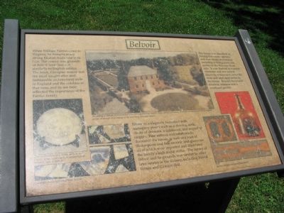
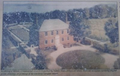
When William Fairfax came to Virginia, he brought many strong English traditions with him. The manor and grounds of Belvoir were laid out similarly to English estates. The brick, Georgian manor was the most sought after and fashionable architectural style in England and the colonies at that time, and its use here reflected the importance of the Fairfax family.
Belvoir was elegantly furnished with mahogany pieces such as a shaving desk, chests of drawers, a sideboard, and imported carpets. Fine mirrors and candlesticks decorated the house as well as a bust of Shakespeare and fine ceramic and glassware, all of which were imported and illustrated the family's high social status. The layout of Belvoir and its grounds was similar to other later estates in the vicinity, including Mount Vernon and Gunston Hall.
The house was described as having five rooms upstairs and four rooms downstairs, including a dining room and parlor on the Potomac River side. It was flanked by exterior chimneys and two central doorway entrances to serve the river and land approaches to the house. Beyond the inland doorway entrance was a courtyard garden.
Topics. This historical marker is listed in this topic list: Colonial Era.
Location. 38° 40.76′ N, 77° 7.74′ W. Marker is in Fort Belvoir, Virginia, in Fairfax County. Marker can be reached from Forney Loop, on the right when traveling east. Located along the Belvoir and Potomac View Trail, reached from a parking area off Forney Lane, on Fort Belvoir. Touch for map. Marker is in this post office area: Fort Belvoir VA 22060, United States of America. Touch for directions.
Other nearby markers. At least 8 other markers are within walking distance of this marker. Ferdinando, and the End of the Fairfax Ownership (a few steps from this marker); The Fairfax Family (a few steps from this marker); The Neighborhood (within shouting distance of this marker); The Influence of the Fairfax Family (within shouting distance of this marker); Life at Belvoir (within shouting distance of this marker); Gardens and Kitchen at Belvoir (within shouting distance of this marker); The Army Comes to Belvoir (within shouting distance of this marker); Belvoir Grounds and Potomac View Trail (about 300 feet away, measured in a direct line). Touch for a list and map of all markers in Fort Belvoir.
More about this marker. The marker is on Fort Belvoir, an active U.S. Army installation. Please check the links below for site access information.
Related markers. Click here for a list of markers that are related to this marker. Lord Fairfax's estates in Virginia
Also see . . .
1. Access to Fort Belvoir. Details procedures for entering the Fort. (Submitted on August 30, 2010, by Craig Swain of Leesburg, Virginia.)
2. 18th Century: Fairfax County's Golden Age. Page discussing the time and setting when Belvoir was built. (Submitted on August 30, 2010, by Craig Swain of Leesburg, Virginia.)
Credits. This page was last revised on June 16, 2016. It was originally submitted on August 30, 2010, by Craig Swain of Leesburg, Virginia. This page has been viewed 793 times since then and 19 times this year. Photos: 1, 2. submitted on August 30, 2010, by Craig Swain of Leesburg, Virginia. 3, 4. submitted on December 16, 2010, by Lee Hattabaugh of Capshaw, Alabama.


