Near Fredericksburg in Spotsylvania County, Virginia — The American South (Mid-Atlantic)
The Battle of Salem Church
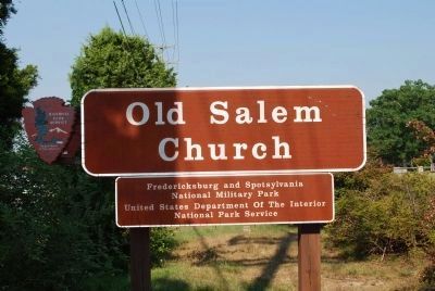
Fredericksburg and Spotsylvania National Military Park
— National Park Service, U.S. Department of the Interior —
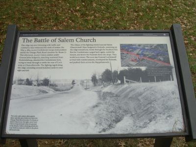
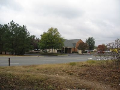
This ridge top now brimming with traffic and commerce once witnessed the clash of armies. On May 3, 1863, 10,000 Confederate troops took position astride the Orange Plank Road (modern Va. Route 3). That afternoon, 20,000 Union soldiers under General John Sedgwick, marching westward from Fredericksburg, attacked the Confederates here, trying to break through to strike the rear of Lee’s army at Chancellorsville. The fighting raged along this ridge extending several hundred yards to your right and left.
The climax of the fighting swirled around Salem Church itself. Here Sedgwick’s Federals, swarming up the ridge toward you, broke through the Southern line. But the Confederates surged back again, sealed the breach, and drove the Federals down the slope. They would not return. The next day General Lee himself arrived with reinforcements, enveloped the Federals, and pushed them across the Rappahannock.
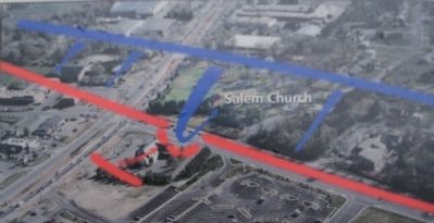
(Caption, upper right picture): The Confederate victory at Salem Church preserved Lee’s position at Chancellorsville, clinching his triumph. Still Lee lamented that the Federal army had escaped at all.
(Caption, main picture): This early 20th-century photograph, taken near this spot, looks east down the Orange Plank Road (modern Va. Route 3). Salem Church is to the right, out of view. Union troops formed in the low ground in the distance before attacking astride the road. Both monuments visible in the photo still stand today.
Erected by National Park Service, U.S. Department of the Interior.
Topics. This historical marker is listed in these topic lists: Churches & Religion • Military • War, US Civil. A significant historical month for this entry is May 1863.
Location. 38° 17.346′ N, 77° 31.873′ W. Marker is near Fredericksburg, Virginia, in Spotsylvania County. Marker can be reached from Old Salem Church Road near Plank Road (Virginia Route 3). Touch for map. Marker is at or near this postal address: 4044 Plank Road, Fredericksburg VA 22407, United States of America. Touch for directions.
Other nearby markers. At least 8 other markers are within walking distance of this marker. A different marker also named Battle of Salem Church (here, next to this marker); From Church to Hospital (here, next to this marker); a different marker also named Battle of Salem Church (a few steps from this marker); Refuge from Horror (within shouting distance of this marker); Old Salem Church (within shouting distance of this marker); Salem Church (within shouting distance of this marker); Churchyard to Battleground (about 300 feet away, measured in a direct line); Sanctuaries in Spotsylvania (about 300 feet away). Touch for a list and map of all markers in Fredericksburg.
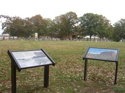
More about this marker. The monuments mentioned in the main picture's caption are linked in the "Related Markers" section.
Regarding The Battle of Salem Church. This is one of five stops at Salem Church related to the Battle of Chancellorsville. See the Salem Church Virtual Tour by Markers in the links section for a listing of related markers on the tour.
Related markers. Click here for a list of markers that are related to this marker. To better understand the relationship, study each marker in the order shown.
Also see . . .
1. Salem Church Virtual Tour by Markers. The Salem Church site, surrounded by modern development, was an important site in the later stages of the Battle and Campaign of Chancellorsville. (Submitted on November 12, 2007, by Craig Swain of Leesburg, Virginia.)
2. Salem Church Walking Trail. National Park Service guide. (Submitted on November 12, 2007, by Craig Swain of Leesburg, Virginia.)
Photographed By Kevin W., November 10, 2007
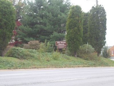
4. Old Salem Church
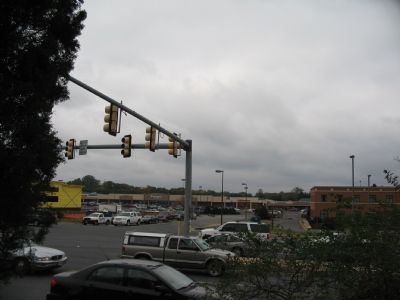
This directional sign, taken from the left turn lane from Plank Road onto Salem Church Road, is only a few steps from "The Battle of Salem Church" marker, showing how close Va. Route 3 (Plank Road) now encroaches on the Old Salem Church site.
Credits. This page was last revised on April 25, 2023. It was originally submitted on November 12, 2007, by Kevin W. of Stafford, Virginia. This page has been viewed 1,607 times since then and 58 times this year. Photos: 1. submitted on November 12, 2007, by Kevin W. of Stafford, Virginia. 2. submitted on November 12, 2007, by Craig Swain of Leesburg, Virginia. 3, 4. submitted on November 12, 2007, by Kevin W. of Stafford, Virginia. 5, 6. submitted on November 12, 2007, by Craig Swain of Leesburg, Virginia. 7. submitted on July 25, 2015, by Brandon Fletcher of Chattanooga, Tennessee.
