West Valley City in Salt Lake County, Utah — The American Mountains (Southwest)
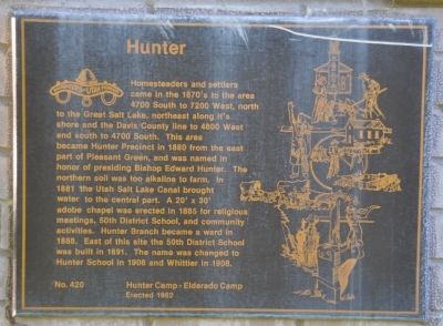
Hunter
Erected 1982 by Daughters of Utah Pioneers; Hunter Camp - Eldorado Camp. (Marker Number 420.)
Topics and series. This historical marker is listed in these topic lists: Churches & Religion • Education • Settlements & Settlers. In addition, it is included in the Daughters of Utah Pioneers series list.
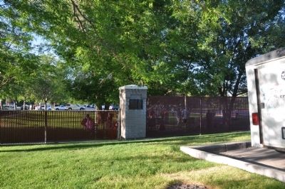
Location. 40° 41.573′ N, 112° 2.05′ W. Marker is in West Valley City, Utah, in Salt Lake County. Marker is at the intersection of 6000 West and Brook Hollow Drive, on the right when traveling north on 6000 West. The marker is on the fence line that separates the Hunter LDS Chapel from Hunter Park. It is located on the south face of the second brick fence pillar from the street. Touch for map. Marker is at or near this postal address: 3665 S 6000 West, West Valley City UT 84128, United States of America. Touch for directions.
Other nearby markers. At least 8 other markers are within 6 miles of this marker, measured as the crow flies. A Struggle For Water (approx. 1.8 miles away); Monroe Community School (approx. 2˝ miles away); Early Granger Schools (approx. 2˝ miles away); Relief Society Granary (approx. 3.1 miles away); Early Magna Settlements (approx. 3.1 miles away); Pleasant Green Ward (approx. 3.6 miles away); English Fort (approx. 5.2 miles away); Carlisle Family Historical Marker (approx. 5.9 miles away). Touch for a list and map of all markers in West Valley City.
Credits. This page was last revised on June 16, 2016. It was originally submitted on August 30, 2010, by Bryan R. Bauer of Kearns, Ut 84118. This page has been viewed 1,010 times since then and 81 times this year. Photos: 1, 2. submitted on August 30, 2010, by Bryan R. Bauer of Kearns, Ut 84118. • Syd Whittle was the editor who published this page.

