Seventh Ward in New Orleans in Orleans Parish, Louisiana — The American South (West South Central)
Faubourg Tremé
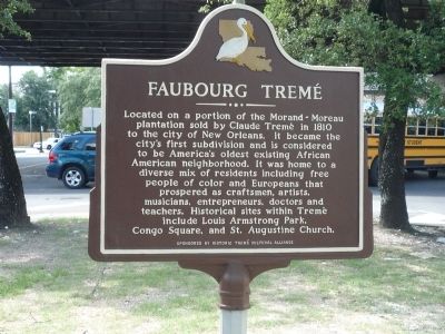
Located on a portion of the Morand-Moreau plantation sold by Claude Faubourg Tremé in 1810 to the city of New Orleans, it became the city’s first subdivision and is considered to be America’s oldest existing African American neighborhood. It was home to a diverse mix of residents including free people of color and Europeans that prospered as craftsmen, artists, musicians, entrepreneurs, doctors and teachers. Historical sites within Tremé include Louis Armstrong Park, Congo Square, and St. Augustine Church.
Erected by Historic Tremé Cultural Alliance.
Topics. This historical marker is listed in these topic lists: African Americans • Agriculture • Arts, Letters, Music • Churches & Religion • Settlements & Settlers. A significant historical year for this entry is 1810.
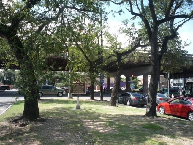
Location. 29° 58.153′ N, 90° 4.103′ W. Marker is in New Orleans, Louisiana, in Orleans Parish. It is in the Seventh Ward. Marker is at the intersection of Esplanade Avenue and No. Claiborne Avenue, in the median on Esplanade Avenue. The marker is approximately 0.1 mile southeast of I-10 and its frontage road, No. Claiborne Avenue. Touch for map. Marker is in this post office area: New Orleans LA 70116, United States of America. Touch for directions.
Other nearby markers. At least 8 other markers are within walking distance of this marker. Straight University (about 500 feet away, measured in a direct line); The Dufour-Baldwin House (about 500 feet away); The Faerie Playhouse (approx. 0.2 miles away); Tomb of the Unknown Slave (approx. 0.3 miles away); Saint Augustine Church, New Orleans (approx. 0.3 miles away); St. Aloysius College (approx. 0.3 miles away); Carmelite Chapel of St. Joseph and St. Teresa and the Carmelite Monastery (approx. 0.4 miles away); Carmelite Monastery (approx. 0.4 miles away). Touch for a list and map of all markers in New Orleans.
Also see . . . Tremé. (Submitted on August 31, 2010, by Richard E. Miller of Oxon Hill, Maryland.)
Credits. This page was last revised on February 12, 2023. It was originally submitted on August 31, 2010, by Richard E. Miller of Oxon Hill, Maryland. This page has been viewed 1,187 times since then and 45 times this year. Photos: 1, 2. submitted on August 31, 2010, by Richard E. Miller of Oxon Hill, Maryland. • Bill Pfingsten was the editor who published this page.

