Brookline near Battlefield in Greene County, Missouri — The American Midwest (Upper Plains)
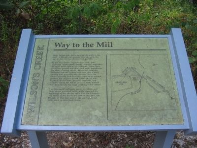
Way to the Mill
Wilson's Creek
In the days before supermarkets and, pre-packaged "ready-made" foods, families depended on small mills such as Mr. Gibson's. Here, their grain was ground into flour and meal, ingredients for many cooking needs. Historical evidence indicates that the Gibson mill was also a wool carding mill preparing the woolen fibers for future spinning and weaving. From miles around farmers and wagons would gather at the mill. Political discussions, weather forecasts and talltales would fill the air as each party waited their turn beside the large creaking water wheel.
The coming of railroads, grain elevators, and large steam powered roller mills signaled the beginning of the end for mills like the Gibson's. Yet, today as we travel the path to the mill, the thought of that lost way of life can supply us with much to take back home.
Topics. This historical marker is listed in this topic list: Industry & Commerce.
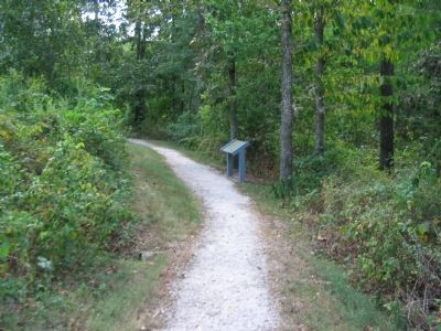
Location. 37° 6.929′ N, 93° 24.43′ W. Marker is near Battlefield, Missouri, in Greene County. It is in Brookline. Marker can be reached from Tour Road, on the right when traveling east. Located at stop 1, Gibson's Mill, of the Wilson's Creek battlefield driving tour. Touch for map. Marker is in this post office area: Brookline MO 65619, United States of America. Touch for directions.
Other nearby markers. At least 8 other markers are within walking distance of this marker. Gibson's Mill (about 500 feet away, measured in a direct line); Signs From The Past (about 800 feet away); Gibson's House Site (approx. 0.2 miles away); Gibson's Mill Site (approx. ¼ mile away); Battle's Beginning ... and End (approx. 0.6 miles away); Ray Springhouse (approx. 0.7 miles away); Fight in Ray's Cornfield (approx. ¾ mile away); Death of Brigadier General Nathaniel Lyon (approx. ¾ mile away). Touch for a list and map of all markers in Battlefield.
Also see . . . Wilson's Creek National Battlefield Park. (Submitted on September 1, 2010, by Craig Swain of Leesburg, Virginia.)
Credits. This page was last revised on February 16, 2023. It was originally submitted on September 1, 2010, by Craig Swain of Leesburg, Virginia. This page has been viewed 772 times since then and 13 times this year. Photos: 1, 2. submitted on September 1, 2010, by Craig Swain of Leesburg, Virginia.

