Highview in Louisville in Jefferson County, Kentucky — The American South (East South Central)
Pennsylvania Run Presbyterian Church and Cemetery
Inscription.
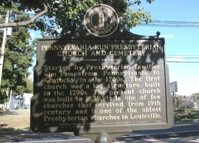
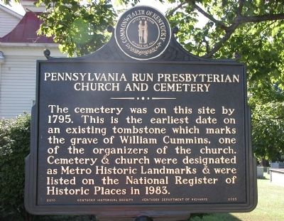
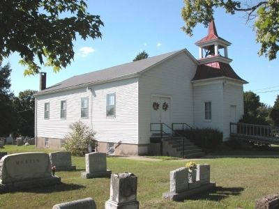
Started by Presbyterian families who came from Pennsylvania to Kentucky in the 1780s. The first church was a log structure built in the 1790s. The present church was built in 1840. It is one of few churches that survived from 19th century and is one of the oldest Presbyterian churches in Louisville.
Erected 2010 by The Kentucky Historical Society & the Kentucky Department of Highways. (Marker Number 2325.)
Topics and series. This historical marker is listed in these topic lists: Cemeteries & Burial Sites • Churches & Religion. In addition, it is included in the Kentucky Historical Society series list. A significant historical year for this entry is 1840.
Location. 38° 7.602′ N, 85° 37.752′ W. Marker is in Louisville, Kentucky, in Jefferson County. It is in Highview. Marker is on Pennsylvania Run Road, 0 miles south of Vaughn Mill Road, on the right when traveling south. Marker is located next to the fence that separates the parking lot from the church grounds and cemetery. Touch for map. Marker is in this post office area: Louisville KY 40228, United States of America. Touch for directions.
Other nearby markers. At least 8 other markers are within 6 miles of this marker, measured as the crow flies. Jefferson County (Kentucky) Korean War Memorial (approx. 1˝ miles away); Cedar Creek Baptist Church (approx. 2.8 miles away); Fern Creek High School (approx. 2.9 miles away); Wilderness Road (approx. 3 miles away); Forest Home Cemetery (approx. 4˝ miles away); Joseph Hite Family Cemetery at Mansfield (approx. 4.6 miles away); Confederate Soldiers Monument (approx. 5˝ miles away); Bashford Manor (approx. 5˝ miles away). Touch for a list and map of all markers in Louisville.
Credits. This page was last revised on February 12, 2023. It was originally submitted on September 6, 2010, by Karl Stelly of Gettysburg, Pennsylvania. This page has been viewed 1,376 times since then and 30 times this year. Photos: 1, 2, 3, 4. submitted on September 6, 2010, by Karl Stelly of Gettysburg, Pennsylvania. • Bill Pfingsten was the editor who published this page.


