Prairie Grove in Washington County, Arkansas — The American South (West South Central)
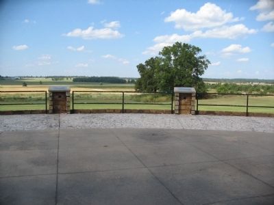
West Battlefield Overlook
(First Panel):
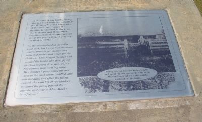
At the time of the battle, Nancy Morton lived with her parents in the William Morton house west of this location. When the fighting intensified in the area, the Mortons and three other families scrambled into the root cellar for protection. As Nancy recalled in 1896:
"...We all remained in the cellar until dark, but I went into the house several times to get victuals and some bedclothes and wraps for the children. They fought through and around the house, the shots flying like hail in every direction, only a few cannon balls striking close. Mrs. Borden's pony stood hitched close to the cook room, saddled, and was not hurt, and after the firing ceased, she with her three children mounted the pony; passed the guards; and rode to Mrs. Mock's in safety..."
Nancy Morton married Rufus Staples and spent the last years of her life in the Morton House which withstood the onslaught of the battle.
(Second Panel):
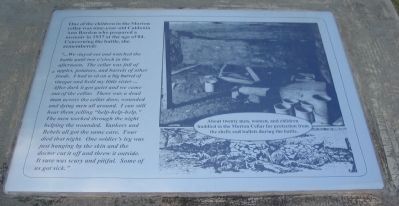
One of the children in the Morton cellar was nine-year-old Caldonia Ann Borden who prepared a memoir in 1937 at the age of 84. Concerning the battle, she remembered:
"...We stayed out and watched the battle until two o'clock in the afternoon. The cellar was full of apples, potatoes, and barrels of other foods. I had to sit on a big barrel of vinegar and hold my little sister... After dark it got quiet and we came out of the cellar. There was a dead man across the cellar door, wounded and dying men all around. I can still hear them yelling "help-help-help." The men worked through the night helping the wounded. Yankees and Rebels all got the same care. Four died that night. One soldier's leg was just hanging by the skin and the doctor cut it off and threw it outside. It sure was scary and pitiful. Some of us got sick."
About twenty men, women, and children huddled in the Morton Cellar for protection from the shells and bullets during the battle.
(Third Panel):
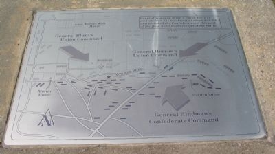
Map of this sector of the battlefield.
Caption:
General James G. Blunt's Union Division arrived from the northwest at about 2:30 P.M. and attacked the Confederates on this part of the field until darkness ended the battle.
(Fourth Panel):
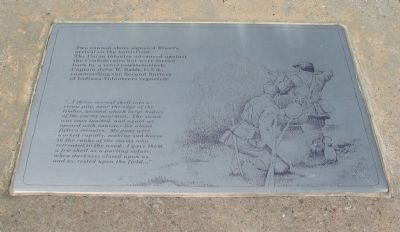
Two cannon shots signaled Blunt's arrival on the battlefield. The Union infantry advanced against the Confederates but were forced back by a rebel counterattack. Captain John W. Rabb, U.S.A., commanding the Second Battery of Indiana Volunteers reported:
"...I threw several shell into a straw pile, near the edge of the timber, around which large bodies of the enemy swarmed. The straw was soon ignited, and again we opened with canister for about fifteen minutes. My guns were worked rapidly, making sad havoc in the ranks of the enemy who retreated to the wood. I gave them a few shell as a parting salute, when darkness closed upon us, and we rested upon the field..."
(Fifth Panel):
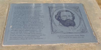
General Mosby M. Parsons' Confederates faced the Union attacks here, then counterattacked. He reported:
"At this time the enemy made furious assaults upon my lines with a galling fire from three batteries, and a concentration of their musketry on my center with the evident intention of breaking it. This fire was more terrible than any I had experienced during the present war. About this time... the enemy were massing their columns in great force on my extreme left. I immediately ordered my reserve regiment...to advance in that direction... In the meantime... General John S. Roane, having ascertained the critical condition of my left, ordered down Col. John B. Clark's Missouri regiment to support me. This it did in the gallant style characteristic of that officer and his gallant command... The enemy was badly beaten... and the sun was getting low, when seeing the enemy advance...I rode to Colonel Steen and remarked to him that the contest must be closed and that I had determined to charge the enemy with bayonet..."
Colonel Alexander Early Steen died leading the last charge of the day.
Topics. This historical marker is listed in this topic list: War, US Civil. A significant historical year for this entry is 1896.
Location. 35° 59.191′ N, 94° 19′ W. Marker is in Prairie Grove, Arkansas, in Washington County. Marker is at the intersection of North Mock Street (County Road 652) and Collins Drive, on the right when traveling north on North Mock Street. Located at stop eleven of the driving tour of Prairie Grove Battlefield State Park. Touch for map. Marker is in this post office area: Prairie Grove AR 72753, United States of America. Touch for directions.
Other nearby markers. At least 8 other markers are within walking distance of this marker. General Shaver's Headquarters (approx. 0.4 miles away); Blunt's Attack (approx. 0.4 miles away); March of the Armies (approx. 0.4 miles away); Hindman Hall Museum (approx. 0.4 miles away); Battle of Prairie Grove (approx. 0.4 miles away); Major General Thomas C. Hindman (approx. 0.4 miles away); Rhea's Mill (approx. 0.4 miles away); Generals James G. Blunt and Francis J. Herron (approx. 0.4 miles away). Touch for a list and map of all markers in Prairie Grove.
Also see . . . Prairie Grove Battlefield State Park. (Submitted on September 7, 2010, by Craig Swain of Leesburg, Virginia.)
Credits. This page was last revised on June 16, 2016. It was originally submitted on September 7, 2010, by Craig Swain of Leesburg, Virginia. This page has been viewed 940 times since then and 11 times this year. Photos: 1, 2, 3, 4, 5, 6, 7. submitted on September 7, 2010, by Craig Swain of Leesburg, Virginia.
