Near Pemaquid in Lincoln County, Maine — The American Northeast (New England)
Ralph Blaisdell and Family
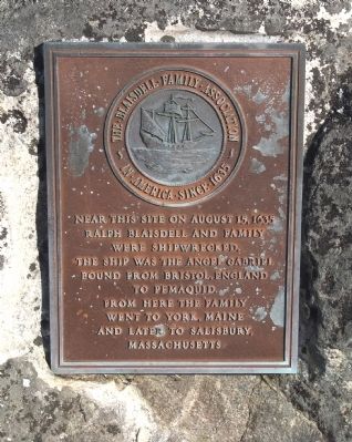
Ralph Blaisdell and family
were shipwrecked.
The ship was the Angel Gabriel
bound from Bristol, England
to Pemaquid.
From here the family
went to York, Maine
and later to Salisbury,
Massachusetts.
Erected by the Blaisdell Family Association, in America since 1635.
Topics. This historical marker is listed in these topic lists: Colonial Era • Disasters • Settlements & Settlers • Waterways & Vessels. A significant historical year for this entry is 1635.
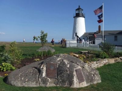
Location. 43° 50.231′ N, 69° 30.38′ W. Marker is near Pemaquid, Maine, in Lincoln County. Marker can be reached from Bristol Road. Marker is in Pemaquid Lighthouse Park, at the south end of Bristol Road. Touch for map. Marker is in this post office area: Pemaquid ME 04558, United States of America. Touch for directions.
Other nearby markers. At least 8 other markers are within 14 miles of this marker, measured as the crow flies. John Cogswell and Family (here, next to this marker); Bell House (within shouting distance of this marker); Oil House (within shouting distance of this marker); Pemaquid Point Lighthouse (within shouting distance of this marker); In Grateful Memory of Ensign Richard Rundlett Wells (approx. 2.4 miles away); Boothbay Maine Civil War Monument (approx. 6.9 miles away); Shipbuilding on the Damariscotta River (approx. 13.6 miles away); R.H.T. Taylor Store in 1882 (approx. 13.9 miles away).
Credits. This page was last revised on January 25, 2021. It was originally submitted on September 8, 2010, by Roger W. Sinnott of Chelmsford, Massachusetts. This page has been viewed 1,980 times since then and 117 times this year. Photos: 1, 2. submitted on September 8, 2010, by Roger W. Sinnott of Chelmsford, Massachusetts. • Bill Pfingsten was the editor who published this page.

