Soda Springs in Caribou County, Idaho — The American West (Mountains)
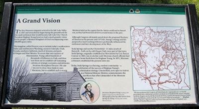
A Grand Vision
Brigham Young Summer Cabin
This Kingdom, called Deseret, was to include today's southeastern Idaho and southwestern Wyoming, western Colorado, Utah, Nevada, southern California, much of Arizona, and parts of Oregon and New Mexico. To secure that vast expanse of Mormondom, Young called hundreds of thousands of followers to Utah, and then sent them out to establish self-sustaining colonies at strategic economic and defensive locations throughout Deseret. His aim was not to close these lands to non-Mormons, but to establish such a strong Mormon hold on the region that the Saints could not be forced out, as they had been forced from several homes in the past.
Although Congress ultimately pared down the proposed Territory of Deseret to the present state of Utah, Young's strategy and his purposeful, hard-working followers profoundly influenced the settlement and later development of the West.
Soda Springs and nearby Chesterfield -- 11 miles north of Bancroft -- both on the old Oregon Trail, were part of that wave. Soda Springs, originally established as Morristown by Col. Patrick Connor in 1863, was in decline until Mormon church officials had a summer home built there for Brigham Young. In 1871, Mormon colonizers established the present town site.
Today, Soda Springs is a thriving, modern community -- a celebration of the success of Brigham Young's colonization strategy. Chesterfield, now open to visitors as a National Historic District, commemorates the sacrifices that effort demanded of the Mormon pioneers.
(Caption beneath map of Deseret): We have petitioned the Congress of the United States for the organization of a territorial government here, embracing a territory of about seven hundred miles square, bounded north by Oregon, east by the Rio Grande del Norte, south by the late line between United States and Mexico, and west by the sea coast and California mountains." -- Brigham Young. March 9, 1849. In a letter to Orson Pratt and the Saints in England.
Erected by National Park Service, Oregon & California National Historic Trails National Trails System. Caribou Historical Society.
Topics. This historical marker is listed in this topic list: Settlements & Settlers. A significant historical date for this entry is March 9, 2002.
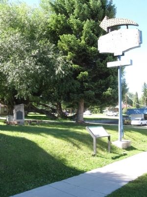
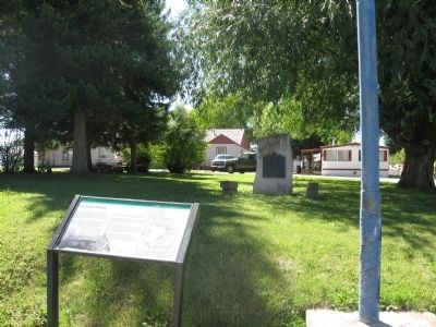
Location. 42° 39.267′ N, 111° 35.983′ W. Marker is in Soda Springs, Idaho, in Caribou County. Marker is on Main Street (U.S. 30). In front of the Brigham Young Lodge. Touch for map. Marker is at or near this postal address: 120 East 2nd Street, Soda Springs ID 83276, United States of America. Touch for directions.
Other nearby markers. At least 8 other markers are within walking distance of this marker. Brigham Young Summer Home (here, next to this marker); Hooper Spring (about 600 feet away, measured in a direct line); Coach History (about 700 feet away); Conda Mine - A phosphate fortune unearthed (approx. 0.2 miles away); Memories of Conda - a company community (approx. 0.2 miles away); General Patrick Edward Connor (approx. 0.2 miles away); Dr. Ellis Kackley (approx. 0.2 miles away); The Dinkey Engine (approx. ¼ mile away). Touch for a list and map of all markers in Soda Springs.
Credits. This page was last revised on June 16, 2016. It was originally submitted on September 8, 2010, by Jack Duffy of West Jordan, Utah. This page has been viewed 907 times since then and 19 times this year. Photos: 1, 2, 3. submitted on September 8, 2010, by Jack Duffy of West Jordan, Utah. • Craig Swain was the editor who published this page.


