Near Rockvale in Rutherford County, Tennessee — The American South (East South Central)
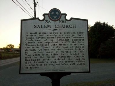
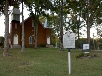
Salem Church
Erected by Tennessee Historical Commission. (Marker Number 3A 196.)
Topics and series. This historical marker is listed in this topic list: Churches & Religion. In addition, it is included in the Tennessee Historical Commission series list. A significant historical year for this entry is 1812.
Location. 35° 48.562′ N, 86° 28.676′ W. Marker is near Rockvale, Tennessee, in Rutherford County. Marker is on Old Salem Road, on the right when traveling west. Touch for map. Marker is in this post office area: Rockvale TN 37153, United States of America. Touch for directions.
Other nearby markers. At least 8 other markers are within 5 miles of this marker, measured as the crow flies. Murfreesboro / Rutherford County (approx. 2.9 miles away); Murfreesboro (approx. 4.3 miles away); George Smith Patton, Jr. (approx. 4˝ miles away); In Memory of Benjamin Liddon (approx. 4.6 miles away); Fields of Fire (approx. 4.7 miles away); Lunette Palmer (approx. 4.7 miles away); Battle at Stones River (approx. 4.7 miles away); Benevolent Cemetery (approx. 4.8 miles away).
Credits. This page was last revised on June 16, 2016. It was originally submitted on September 8, 2010, by Tom Gillard of Tullahoma, Tennessee. This page has been viewed 848 times since then and 32 times this year. Photos: 1, 2. submitted on September 8, 2010, by Tom Gillard of Tullahoma, Tennessee. • Craig Swain was the editor who published this page.

